Effluence, New South wales
| Effluence New South Wales | |||||||||
|---|---|---|---|---|---|---|---|---|---|
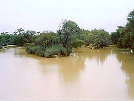 Paroo River at Effluence | |||||||||
|
Effluence | |||||||||
| Coordinates | 29°42′18″S 144°05′24″E / 29.70500°S 144.09000°ECoordinates: 29°42′18″S 144°05′24″E / 29.70500°S 144.09000°E | ||||||||
| Population | 140 (area) (2016 census)[1] | ||||||||
| Postcode(s) | 2840 | ||||||||
| Elevation | 110 m (361 ft) | ||||||||
| LGA(s) | Bourke Shire | ||||||||
| State electorate(s) | Barwon | ||||||||
| Federal Division(s) | Parkes | ||||||||
| |||||||||
Effluence, New South Wales is a remote rural locality of Bourke Shire, New South wales.
Effluence is on the Paroo River opposite the town of Wanaaring, New South Wales. Effluence is in both Barrona and Irrara County,[2] cadasteral divisions of New South Wales.[3]
Geography
Location
Effluence is some 980 kilometres from Sydney, and 180 km west of Bourke.
Climate
The topography of Effluence is flat and arid with a Köppen climate classification of BSh (Hot semi arid)[4].
The climate is semi-arid, featuring low rainfall, very hot summer temperatures and cool nights in winter. A minimum temperature of -3.9°C was recorded in July 1997.[5]
| Wanaaring | ||||||||||||||||||||||||||||||||||||||||||||||||||||||||||||
|---|---|---|---|---|---|---|---|---|---|---|---|---|---|---|---|---|---|---|---|---|---|---|---|---|---|---|---|---|---|---|---|---|---|---|---|---|---|---|---|---|---|---|---|---|---|---|---|---|---|---|---|---|---|---|---|---|---|---|---|---|
| Climate chart (explanation) | ||||||||||||||||||||||||||||||||||||||||||||||||||||||||||||
| ||||||||||||||||||||||||||||||||||||||||||||||||||||||||||||
| ||||||||||||||||||||||||||||||||||||||||||||||||||||||||||||
Population
At the 2011 census, Wanaaring area had a population of 140.[1]
Economy
The economy in the parish is based on broad acre agriculture, mainly Cattle, and sheep goats. Honey is also produced. There is an all whether airstrip for effluence.
History
The area is in the traditional lands of the Paaruntyi people and The Burke and Wills expedition were the first Europeans to the area.
References
- 1 2 Australian Bureau of Statistics (27 June 2017). "Wanaaring (State Suburb)". 2016 Census QuickStats. Retrieved 5 April 2015.

- ↑ County of Irrara, Western Division, Land District of Bourke, Darling Shire / compiled, drawn & printed at the Department of Lands, Sydney, N.S.W (Department of Lands, Sydney N.S.W, 1964).
- ↑ "Irrara County". Geographical Names Register (GNR) of NSW. Geographical Names Board of New South Wales.
- ↑ Peel, M. C.; Finlayson, B. L.; McMahon, T. A. (2007). "Updated world map of the Köppen–Geiger climate classification". Hydrol. Earth Syst. Sci. 11: 1633–1644. doi:10.5194/hess-11-1633-2007. ISSN 1027-5606. (direct: Final Revised Paper)
- ↑ http://www.bom.gov.au/climate/averages/tables/cw_048079_All.shtml