Edwards Mountain
| Edwards Mountain | |
|---|---|
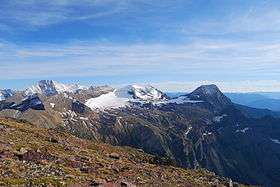 Sperry Glacier with Edwards Mountain at right | |
| Highest point | |
| Elevation | 9,076 ft (2,766 m) [1] NAVD 88 |
| Prominence | 1,072 ft (327 m) [1] |
| Coordinates | 48°37′22″N 113°47′10″W / 48.62278°N 113.78611°WCoordinates: 48°37′22″N 113°47′10″W / 48.62278°N 113.78611°W [2] |
| Geography | |
 Edwards Mountain | |
| Parent range | Lewis Range |
| Topo map | USGS Lake McDonald East, MT |
| Climbing | |
| First ascent | Unknown |
Edwards Mountain (9,076 feet (2,766 m)) is located in the Lewis Range, Glacier National Park in the U.S. state of Montana.[3] Edwards Mountain rises just to the west of Sperry Glacier.
See also
References
- 1 2 "Edwards Mountain, Montana". Peakbagger.com. Retrieved June 7, 2018.
- ↑ "Edwards Mountain". Geographic Names Information System. United States Geological Survey. Retrieved June 7, 2018.
- ↑ Lake McDonald East, MT (Map). TopoQwest (United States Geological Survey Maps). Retrieved June 7, 2018.
This article is issued from
Wikipedia.
The text is licensed under Creative Commons - Attribution - Sharealike.
Additional terms may apply for the media files.