Eastern Yar
| River Yar (Eastern Yar) | |
| River | |
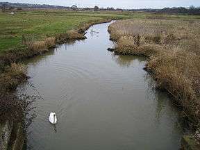 The Eastern Yar at Brading marshes | |
| Country | England |
|---|---|
| Region | Isle of Wight |
| Tributaries | |
| - left | Scotchells Brook |
| Source | |
| - location | Niton, Isle of Wight |
| Mouth | The Solent |
| - location | Bembridge, Isle of Wight |
| Length | 20 km (12 mi) |


The River Yar on the Isle of Wight, England, rises in a chalk coomb in St. Catherine's Down near Niton,[1] close to the southern tip of the island. It flows across the Lower Cretaceous rocks of the eastern side of the island, through the gap in the central Upper Cretaceous chalk ridge of the Island at Yarbridge, then across the now drained Brading Haven to Bembridge Harbour in the north east.
For most of its course, the river passes through rural areas. At Alverstone, a small weir uses water from the river to power a water mill.
The Yar is one of two rivers on the Isle of Wight with the same name. It is referred to as the Eastern Yar if it is necessary to distinguish between them.
References
- ↑ "River Yar Trail - Source to Sea". WightCam. Archived from the original on 2009-04-23. Retrieved 2009-06-17.
Ordnance Survey One Inch Seventh Series sheet 180
External links
| Wikimedia Commons has media related to Eastern Yar. |
Coordinates: 50°41′32″N 1°06′39″W / 50.69222°N 1.11083°W