East Haddam Bridge
| East Haddam Swing Bridge | |
|---|---|
 The bridge in 2011 | |
| Coordinates | 41°27′06″N 72°27′52″W / 41.45173°N 72.46432°WCoordinates: 41°27′06″N 72°27′52″W / 41.45173°N 72.46432°W |
| Carries |
|
| Crosses | Connecticut River |
| Locale | Haddam and East Haddam, Connecticut |
| Maintained by | Connecticut Department of Transportation |
| ID number | 1138[1] |
| Characteristics | |
| Design | Swing truss |
| Total length | 881 feet (269 m)[1] |
| Width | 24.6 ft (7.5 m) |
| Longest span |
456 feet (139 m)[1] 326.1 feet (99.4 m)[2] |
| Clearance below | 24.9 ft (7.6 m) |
| History | |
| Opened | 1913 (rebuilt 1999) |
| Statistics | |
| Daily traffic | 11,600 |
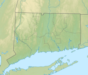
 East Haddam Swing Bridge Location in Connecticut | |
The East Haddam Swing Bridge, bridge number 1138, is a steel, movable (swing) truss bridge. It's composed of three spans crossing the Connecticut River between Haddam, Connecticut and East Haddam, Connecticut.[3] The bridge carries Route 82, with an average daily traffic of 11,600.[4] At the time of its construction, it was reputed to be the longest swing bridge of its kind in the world.[5]
History
In 1909, a Governor's commission on transportation recommended the construction of a bridge over the Connecticut River connecting East Haddam and Haddam.[6] Accepting this recommendation, to the triumph of the local communities, the state diverted aid used to fund ferry services to building the East Haddam Bridge,[6] becoming one of the first bridges funded by the state.[3] Since ferry service had been the main mode of transportation beginning in 1694, the East Haddam bridge marked a shift toward more modern means for travel across the Connecticut River.[7] Construction of the bridge began in April 1912 and was completed in June 1913.[6]
On June 14, 1913, Flag Day, the East Haddam Swing Bridge officially opened. It was hailed as an ornament to the "age of progressiveness".[6] The celebration included an address by Governor Simeon E. Baldwin, a 17-gun salute, a Model-T automobile parade, and a concert that drew thousands to the event.[7]
At the time, the State Highway Department had no authority over bridges.[3] This meant the state legislature formed special commissions took the lead on building the East Haddam Bridge.[3] Legislation in 1915 gave the responsibility for all trunk-line bridges in Connecticut, including the East Haddam Bridge, over to the State Highway Department.[3]
A centennial celebration for the bridge was marked on June 15, 2013 with a local parade of antique cars.[7] The East Haddam swing bridge has been judged as being "Individually Eligible for the National Register of Historic Places".[8]
Construction
The state hired Edward W. Bush, a prominent civil engineer in Connecticut at the time, to be the chief engineer of the project.[6] He also designed the piers and approach roadways.[3] Additional Boller, Hodge & Baird engineers were hired.[3] A contract for the superstructure of the bridge was given to Holbrook, Cabot, and Rollins of Boston.[6] A contract for the substructure of the bridge was given to American Bridge Company.[6] The pin-connected drawbridge was designed by Alfred P. Boller, an authority on deep bridge foundations, to allow the bridge to pivot/swing, clearing a path for through river travel.[9]
The 3 spans of the bridge are all composed of rivet-connecting steel members.[6] From west to east, the three spans include: A Warren deck truss (101 ft long), a Pennsylvania through truss (327 ft long and one of the longest in the state[3]), and a swing span (461 ft long).[6] Together they bring the total length of the swing bridge to 889 ft.[10][9] The stone-block piers and abutments are built on timber pilings.[3]
The East Haddam Bridge incorporates numerous interesting technical features, including a center-bearing pivot and moving-wedge end lifts that support the ends of the bridge when closed.[3]
See also
References
- 1 2 3 Bruce Clouette and Matthew Rot. "East Haddam Bridge, Bridge No. 1138". CDOT. Retrieved 2008-09-22.
- ↑
- 1 2 3 4 5 6 7 8 9 10 "East Haddam Bridge". past-inc.org. Retrieved 2017-09-27.
- ↑ State of Connecticut Department of Transportation: 2006 Traffic Volumes State Maintained Highway Network. (2006). Division of Systems Information, Bureau of Policy and Planning. Retrieved from http://www.ct.gov/dot/LIB/dot/Documents/dpolicy/traflog/traflog.pdf
- ↑
- 1 2 3 4 5 6 7 8 9 Roth, M. (1981). Connecticut: An Inventory of Historic Engineering and Industrial Sites. Society for Industrial Archeology.Retrieved from http://cttrust.org/_IMAGES/Roth%201980%20Survey(1).pdf
- 1 2 3 "East Haddam Swing Bridge – Today in History: June 14 | ConnecticutHistory.org". connecticuthistory.org. Retrieved 2017-09-27.
- ↑ "National Register List". past-inc.org. Retrieved 2017-09-27.
- 1 2 Delaware.Net. "Attractions". www.easthaddam.org. Retrieved 2017-09-27.
- ↑ 2016-2017 Greater Hartford & Connecticut River Valley Visitors Guide. http://www.ctvisit.com/sites/default/files/201617_CenterofCT_VisitorsGuide.pdf
External links
| Wikimedia Commons has media related to East Haddam Swing Bridge. |