East Coulee, Alberta
| East Coulee | |
|---|---|
| Former hamlet | |
 Location of East Coulee in Alberta | |
| Coordinates: 51°20′10″N 112°29′24″W / 51.336°N 112.490°WCoordinates: 51°20′10″N 112°29′24″W / 51.336°N 112.490°W | |
| Country |
|
| Province |
|
| Census division | No. 5 |
| Municipality | Town of Drumheller |
| Government[1] | |
| • Mayor | Heather Colberg |
| • Governing body |
Drumheller Town Council
|
| Area[2] | |
| • Land | 1.39 km2 (0.54 sq mi) |
| Elevation | 675 m (2,215 ft) |
| Population (2016)[2] | |
| • Total | 148 |
| Time zone | UTC-7 (MST) |
East Coulee is a community within the Town of Drumheller, Alberta, Canada. It was previously a hamlet within the former Municipal District (MD) of Badlands No. 7[3] prior to the MD's amalgamation with the former City of Drumheller on January 1, 1998.[4] It is also recognized as a designated place by Statistics Canada.[5]
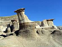
East Coulee is located on Highway 10, approximately 20 km (12 mi) southeast of Drumheller's main townsite and 112 km (70 mi) northeast of Calgary. It lies in the Red Deer River valley and has an elevation of 675 m (2,215 ft). The community is within Census Division No. 5 and in the federal riding of Crowfoot.
It was one of the filming locations of the television series MythQuest.
Demographics
As a designated place in the 2016 Census of Population conducted by Statistics Canada, East Coulee recorded a population of 148 living in 87 of its 119 total private dwellings, a change of 5.7% from its 2011 population of 140. With a land area of 1.39 km2 (0.54 sq mi), it had a population density of 106.5/km2 (275.8/sq mi) in 2016.[2]
As a designated place in the 2011 Census, East Coulee had a population of 140 living in 77 of its 95 total dwellings, a -20.9% change from its 2006 population of 177. With a land area of 1.14 km2 (0.44 sq mi), it had a population density of 123/km2 (318/sq mi) in 2011.[5]
See also
References
- ↑ "Municipal Officials Search". Alberta Municipal Affairs. September 22, 2017. Retrieved September 25, 2017.
- 1 2 3 "Population and dwelling counts, for Canada, provinces and territories, and designated places, 2016 and 2011 censuses – 100% data (Alberta)". Statistics Canada. February 8, 2017. Retrieved February 13, 2017.
- ↑ "Town of Drumheller Municipal Development Plan: Volume 1 Background Study" (PDF). Town of Drumheller and Palliser Regional Municipal Services. April 21, 2008. p. 5. Retrieved October 10, 2013.
- ↑ "Location and History Profile: Town of Drumheller". Alberta Municipal Affairs. October 4, 2013. Retrieved October 10, 2013.
- 1 2 "Population and dwelling counts, for Canada, provinces and territories, and designated places, 2011 and 2006 censuses (Alberta)". Statistics Canada. 2012-02-08. Retrieved 2012-04-07.
Places adjacent to East Coulee, Alberta | |
|---|---|