Eagle Peak (California)
| Eagle Peak | |
|---|---|
 | |
| Highest point | |
| Elevation | 9,897 ft (3,017 m) NAVD 88[1] |
| Prominence | 4,352 ft (1,326 m) [2] |
| Listing | California county high points 15th |
| Coordinates | 41°17′00″N 120°12′03″W / 41.283441436°N 120.200754167°WCoordinates: 41°17′00″N 120°12′03″W / 41.283441436°N 120.200754167°W [1] |
| Geography | |
 Eagle Peak Location in California | |
| Location | Modoc County, California, U.S. |
| Parent range | Warner Mountains |
| Topo map | USGS Eagle Peak |
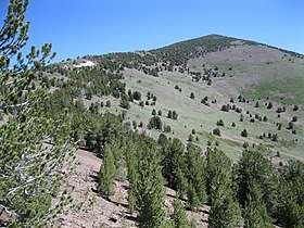
Eagle Peak is located in the Warner Mountains in Modoc County, California. The area is protected in the South Warner Wilderness on the Modoc National Forest. The summit is the highest point in the Warner Mountains and Modoc County.[2] Much of the precipitation that falls on Eagle Peak is snow due to the high elevation of the mountain.[3]
See also
References
- 1 2 "Eagle". NGS data sheet. U.S. National Geodetic Survey. Retrieved 2009-08-01.
- 1 2 "Eagle Peak, California". Peakbagger.com. Retrieved 2009-01-30.
- ↑ "Subsection M261Gf - Warner Mountains". U.S. Forest Service. Archived from the original on 2005-03-15. Retrieved 2007-11-21.
External links
- "Eagle Peak". Geographic Names Information System. United States Geological Survey. Retrieved 2009-08-01.
This article is issued from
Wikipedia.
The text is licensed under Creative Commons - Attribution - Sharealike.
Additional terms may apply for the media files.