Earthquake warning system

An earthquake warning system is a system of accelerometers, seismometers, communication, computers, and alarms that is devised for regional notification of a substantial earthquake while it is in progress. This is not the same as earthquake prediction, which is currently incapable of producing decisive event warnings.
Time lag and wave projection
An earthquake is caused by the release of stored elastic strain energy during rapid sliding along a fault. The sliding starts at some location and progress away from the hypocenter in each direction along the fault surface. The speed of the progression of this fault tear is slower than, and distinct from the speed of the resultant pressure and shear waves, with the pressure wave traveling faster than the shear wave. The pressure waves generate an abrupt shock. The shear waves generate periodic motion (at about 1 Hz) that is the most destructive to structures, particularly buildings that have a similar resonant period. Typically these buildings are around eight floors in height. These waves will be strongest at the ends of the slippage, and may project destructive waves well beyond the fault failure. The intensity of such remote effects are highly dependent upon local soils conditions within the region and these effects are considered in constructing a model of the region that determines appropriate responses to specific events.
Transit safety
Such systems are currently implemented to determine appropriate real-time response to an event by the train operator in urban rail systems such as BART (Bay Area Rapid Transit). The appropriate response is dependent on the warning time, the local right–of–way conditions and the current speed of the train.
Deployment
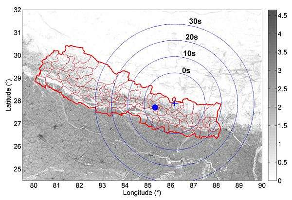
.svg.png)
As of 2016, Japan and Taiwan have comprehensive, nationwide earthquake early warning systems. Other countries and regions have limited deployment of earthquake warning systems, including Mexico (the Mexican Seismic Alert System covers areas of central and southern Mexico including Mexico City and Oaxaca), limited regions of Romania (the Basarab bridge in Bucharest), and parts of the United States. The earliest automated earthquake pre-detection systems were installed in the 1990s; for instance, in California, the Calistoga fire station's system which automatically triggers a citywide siren to alert the entire area's residents of an earthquake.[3] Some California fire departments use their warning systems to automatically open overhead doors of fire stations before the earthquake can disable them. While many of these efforts are governmental, several private companies also manufacture earthquake early warning systems to protect infrastructure such as elevators, gas lines and fire stations.
The Mexican Seismic Alert System began operations in 1991 and began publicly issuing alerts in 1993. Initially serving Mexico City with twelve sensors, the system now has 97 sensors and is designed to protect life and property in several central and southern Mexican states.
Japan's Earthquake Early Warning system was put to practical use in 2006. The system that warns the general public was installed on October 1, 2007.[4][5] It was modeled partly on the Urgent Earthquake Detection and Alarm System (UrEDAS) of Japan Railways, which was designed to enable automatic braking of bullet trains.[6]
In 2009, an early warning system called ShakeAlarm was installed and commissioned in Vancouver, British Columbia, Canada. It was placed to protect a piece of critical transportation infrastructure called the George Massey Tunnel, which connects the north and south banks of the Fraser River. In this application the system automatically closes the gates at the tunnel entrances if there is a dangerous seismic event inbound.[7] The success and the reliability of the system was such that as of 2015 there have been several additional installations on the west coast of Canada and the United States, and there are more being planned.
In January 2013, Francesco Finazzi of the University of Bergamo started the Earthquake Network research project which aims at developing and maintaining a crowdsourced earthquake warning system based on smartphone networks.[2][8] Smartphones are used to detect the ground shaking induced by an earthquake and a warning is issued as soon as an earthquake is detected. People living at a further distance from the epicenter and the detection point may be alerted before they are reached by the damaging waves of the earthquake. People can take part in the project by installing the Android application "Earthquake Network" on their smart phones. The app requires the phone to receive the alerts.
In December 2014, the United States Congress approved a $5 million allocation as part of the Consolidated Appropriations Act, 2014 in order to expand funding for development of the system.[9]
The United States Geological Survey (USGS) has investigated collaboration with the social networking site Twitter to allow for more rapid construction of ShakeMaps.[10][11] As of May 2015, USGS began testing an earthquake early warning app. QuakeAlert was developed by Early Warning Labs in partnership USGS.[12]
In July 2015, the USGS awarded $4 million in funding to the Berkeley Seismological Laboratory, the California Institute of Technology and the University of Washington, to turn the current ShakeAlert early warning prototype into a more robust system that could be used by "cities, industries, utilities and transportation networks in California, Oregon and Washington".[13]
Gravimetric data from the 2011 Tōhoku earthquake has been used to create a model for increased warning time compared to seismic models, as gravity fields travel faster than seismic waves.[14]
See also
References
- ↑ Burkett, Erin R.; Given, Douglas D.; Jones, Lucile M.; Jones, Erin R. Burkett, Douglas D. Given, and Lucile M. (2014-01-01). "ShakeAlert: an earthquake early warning system for the United States West Coast". U.S. Geological Survey Fact Sheet 2014–3083. doi:10.3133/fs20143083.
- 1 2 Finazzi, Francesco; Fassò, Alessandro (2016). "A statistical approach to crowdsourced smartphone-based earthquake early warning systems". Stochastic Environmental Research and Risk Assessment. arXiv:1512.01026. doi:10.1007/s00477-016-1240-8. Retrieved 31 March 2016.
- ↑ Podger, Pamela (July 2001). "Calistoga to get an earful of nation's first quake siren". napanet.
- ↑ "What is an Earthquake Early Warning?". Japan Meteorological Agency. Retrieved on 2008-06-29.
- ↑ "Overview of the Earthquake Early Warning System" (in Japanese). Japan Meteorological Agency. Archived from the original on 2008-03-12. Retrieved 2008-06-29.
- ↑ Kumagai, Jean (June 2007). "A BriefHistory of Earthquake Warnings". IEEE Spectrum. Retrieved 2009-05-09.
- ↑ Zaicenco, Anton; Weir-Jones, Iain (September 2012). "Lessons Learned from Operating an On-site Earthquake Early Warning System" (PDF). Proceedings, World Conference on Earthquake Engineering. 15th (2012): 10. Retrieved September 28, 2012.
- ↑ Finazzi, Francesco (2016). "The Earthquake Network Project: Toward a Crowdsourced Smartphone‐Based Earthquake Early Warning System". Bulletin of the Seismological Society of America. doi:10.1785/0120150354. Retrieved 10 June 2016.
- ↑ Lin II, Rong-Gong (December 14, 2014). "California receives U.S. funding for earthquake early-warning system". Los Angeles Times. Retrieved 2014-12-31.
- ↑ Mahalia Miller, Lynne Burks, and Reza Bosagh Zadeh Rapid Estimate of Ground Shaking Intensity by Combining Simple Earthquake Characteristics with Tweets, Tenth U.S. National Conference on Earthquake Engineering
- ↑ Zadeh, Reza (May 2, 2014). "Using Twitter to measure earthquake impact in almost real time". Twitter Engineering.
- ↑ Staff (May 27, 2015). "USGS Tests QuakeAlert App with 60-Second Warning". Geospatial Solutions.
- ↑ "Earthquake early warning system moves closer to reality". Retrieved 2015-08-23.
- ↑ "Prompt gravity signal induced by the 2011 Tohoku-Oki earthquake". Bibcode:2016NatCo...713349M. doi:10.1038/ncomms13349.
External links
| Wikimedia Commons has media related to Earthquake warning system. |
- Earthquake Early Warning – United States Geological Survey
- Earthquake Early Warning – California Institute of Technology
- Bayesian Networks for Earthquake Magnitude Classification in a Early Warning System
- Earthquake Network - The Earthquake Network project website
- Earthquake Early Warning for Developing Countries - Grillo website