Dymi, Achaea
| Dymi Δύμη | |
|---|---|
 Dymi Location within the regional unit 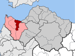 | |
| Coordinates: 38°8′N 21°33′E / 38.133°N 21.550°ECoordinates: 38°8′N 21°33′E / 38.133°N 21.550°E | |
| Country | Greece |
| Administrative region | West Greece |
| Regional unit | Achaea |
| Municipality | West Achaea |
| • Municipal unit | 71.55 km2 (27.63 sq mi) |
| Elevation | 48 m (157 ft) |
| Population (2011)[1] | |
| • Municipal unit | 10,227 |
| • Municipal unit density | 140/km2 (370/sq mi) |
| Time zone | UTC+2 (EET) |
| • Summer (DST) | UTC+3 (EEST) |
| Postal code | 252 00 |
| Area code(s) | 26930 |
| Vehicle registration | ΑΧ |
| Website | www.dymi.gr |
Dymi (Greek: Δύμη) is a former municipality in Achaea, West Greece, Greece. Since the 2011 local government reform it is part of the municipality West Achaea, of which it is a municipal unit.[2] The municipal unit has an area of 71.553 km2.[3] Its seat of administration was the town of Kato Achaia. It is located 20 km southwest of Patras.
Population history
| Year | Municipality Dymi |
|---|---|
| 1991 | 8,765 |
| 2001 | 10,664 |
| 2011 | 10,227 |
Subdivisions
The municipal unit Dymi is subdivided into the following communities (constituent villages in brackets):
- Kato Achaia (Kato Achaia, Alykes, Manetaiikia, Paralia Kato Achaias, Piso Sykea)
- Agiovlasitika (Agiovlasitika, Kapeli, Lefkos, Stenaitika)
- Alissos (Alissos, Kamenitsa, Paralia Alissou, Profitis Elissaios)
- Ano Achaia
- Elaiochori
- Kato Alissos (Kato Alissos, Gialos)
- Niforeika (Niforeika, Paralia Niforeikon)
- Petrochori (Petrochori, Veskoukaiika, Vythoulkas, Zampeteika, Karya, Lampraiika, Logothetis)
See also
- Dyme, ancient city
- List of settlements in Achaea
References
- ↑ "Απογραφή Πληθυσμού - Κατοικιών 2011. ΜΟΝΙΜΟΣ Πληθυσμός" (in Greek). Hellenic Statistical Authority.
- ↑ Kallikratis law Greece Ministry of Interior (in Greek)
- ↑ "Population & housing census 2001 (incl. area and average elevation)" (PDF) (in Greek). National Statistical Service of Greece. Archived from the original (PDF) on 2015-09-21.
External links
Places adjacent to Dymi, Achaea | |
|---|---|
This article is issued from
Wikipedia.
The text is licensed under Creative Commons - Attribution - Sharealike.
Additional terms may apply for the media files.