Neighborhoods of Albany, New York

The neighborhoods of Albany, New York are varied demographically, geographically, architecturally, and historically. Downtown Albany is the city's oldest neighborhood, centered on State Street, one of Albany's oldest streets and its original main street. North and south of Downtown Albany are old residential communities often consisting of row houses; to the north, those neighborhoods include Sheridan Hollow, Arbor Hill, and North Albany, while to the south is the super-neighborhood of the South End, which includes several smaller neighborhoods.
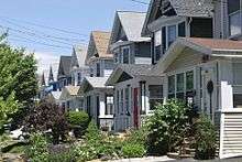
On the western edge of Downtown Albany is the Empire State Plaza, which effectively cuts Downtown off from the gentrified neighborhoods of Center Square and Hudson/Park. Single-family detached homes, duplexes, and apartments, along with single-family houses that have been divided into multiple units, can be found west of the older neighborhoods. These neighborhoods, such as Helderberg, New Scotland/Woodlawn, and Pine Hills, tend to have larger lots and more suburban surroundings than the neighborhoods nearer to the Hudson River. Further west, the neighborhoods become more affluent and are dominated almost exclusively by single-family dwellings. The western portion of the City includes the W. Averell Harriman State Office Building Campus and the University at Albany's main campus, as well as offices and commercial properties lining frontage roads along Washington Avenue Extension.
Neither the W. Averell Harriman State Office Building Campus nor the campuses of The University at Albany and the Colleges of Nanoscale Science and Engineering nor the non-residential Port of Albany are listed as neighborhoods or portions of neighborhoods on this page.
Arbor Hill
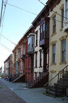
Arbor Hill[1] is an historic neighborhood in northeastern Albany near the Hudson River. Arbor Hill encompasses the area from Clinton Avenue (formerly called Patroon Street) north to the Livingston Avenue Railroad Bridge (where North Albany begins) and from the Hudson River west to Henry Johnson Boulevard.[2] Arbor Hill was outside Albany's first boundaries as set up in the Dongan Charter of 1686. The original name of the area was Colonie. Incorporated as a village on April 9, 1804, Arbor Hill was annexed by the city in 1815, at which time Patroon Street became Clinton Avenue.[3] The name "Arbor Hill" comes from the nickname of the Ten Broeck Mansion, an important cultural and historical destination in the neighborhood. Arbor Hill includes Dudley Heights, a residential neighborhood north of Livingston Avenue that was the first location of the Dudley Observatory.[4] Arbor Hill contains many other historic and cultural spots including the Palace Theatre, Quackenbush House, Church of the Holy Innocents, the Stephen and Harriet Myers House, and the former St. Joseph's Church. Demographically, Arbor Hill is predominantly African-American.
Beverwyck
A small neighborhood of interior streets between Central and Washington Avenues, Beverwyck[5][6] is mostly residential. The neighborhood received its name from Beverwyck Park, which in turn was named for Albany's original Dutch name, Beverwyck.
Bishop's Gate
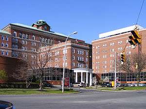
Bishop's Gate is a small portion of the City of Albany that lies north of Interstate 90 and west of Route Nine.[7] The neighborhood is bounded on the north and west by the Town of Colonie and the Hamlet of Loudonville. Bishop's Gate is mostly residential; it includes Albany Memorial Hospital.
Buckingham Lake

The Buckingham Lake neighborhood is bordered by Western Avenue on the north, Route 85 on the west, Krumkill Road and New Scotland Avenues on the south, and South Manning Boulevard on the east.[8][9] The central attraction of the neighborhood is Buckingham Lake Park, which features the lake itself (also known as Buckingham Pond) along with hiking trails. Local amenities are within easy walking distance on New Scotland and Western Avenues. Homes in the Buckingham Lake neighborhood are primarily single-family and are located on tree-lined streets, some of which have medians. The Buckingham Lake neighborhood includes some of the largest and most distinctive houses in the entire City of Albany.
Center Square
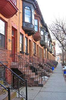
Center Square[10][5] contains many buildings of architectural significance and is locally famous for its nightlife, entertainment, culture, and dining. Center Square includes the area bounded by Lark Street on the west, Spring Street on the north, South Swan Street on the east and Jay Street on the south, as well as the upper portion of Lancaster Street between Lark Street and Willett Street. It is included in its entirety within the Center Square/Hudson–Park Historic District. Center Square is also notable for its close proximity to Washington Park. Center Square and the Hudson/Park neighborhood to the south are often compared to New York City's Greenwich Village for their eclectic mix of residential and commercial uses, including bars, night clubs, restaurants, and unique stores. Albany's gay culture is vibrant in this area.[11] Residential properties in Center Square consist chiefly of townhouses, many of which date to the nineteenth and early twentieth centuries.
Downtown Albany

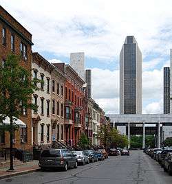
Downtown Albany is one of the city's oldest neighborhoods. The neighborhood is roughly bounded by Sheridan Hollow and Arbor Hill to the north, the South End to the south, Route 787 to the east, and the Empire State Plaza to the west. Downtown Albany is centered on the intersection between State Street (one of Albany's oldest streets and its original main street) and Pearl Street.
Downtown Albany includes locations of architectural, cultural, historical, political, and religious significance, including Albany City Hall, the Albany County Courthouse, the New York Court of Appeals Building, the New York State Capitol, the New York State Education Department, the SUNY System Administration Building, and the Times Union Center. While Downtown Albany is primarily non-residential, there are residences interspersed within its collection of banks, bars, hotels, monuments, office buildings, parks, restaurants, and retail spaces. Downtown Albany is connected to the Corning Preserve, a 15-acre park and entertainment venue on the west side of the Hudson River, by the Hudson River Way, a pedestrian walkway that begins east of Broadway and passes over Route 787.
Eagle Hill
Eagle Hill[12][5] is a residential neighborhood in western Albany near the Town of Guilderland that is named for the Eagle Hill Cemetery. Eagle Hill is a large neighborhood "bounded by the [W. Averell Harriman State Office Building Campus] to the north, parts of Krumkill Road and the State Thruway (Interstate 87) to the south, an assortment of streets to the west (including Arch Avenue, North Bridge Drive and Wood Street), and Route 85 and the Buckingham Lake neighborhood to the east." Eagle Hill is an ethnically diverse community that has been described as "a tranquil, pretty place with narrow, tree-lined streets and small city lots with a mix of housing styles."[13]
Helderberg
The Helderberg neighborhood[14] can be roughly defined by the quadrangle formed by New Scotland Avenue to the north, South Manning and Hackett Boulevards to the west and south, respectively, and Academy Road to the east. Its namesake is Helderberg Avenue, a small road that runs roughly east-west between Hackett Boulevard and New Scotland Avenue. The mostly residential neighborhood includes one-family and multifamily homes, and is situated between the city's two primary hospitals, St. Peter's Hospital and Albany Medical Center. Helderberg borders the combined campus of Albany Law School, Albany College of Pharmacy and the Sage College of Albany, located in the University Heights neighborhood. The Albany Academies, a prep school for boys and girls, is located at the southeast end of the neighborhood.
Hudson/Park
Albany’s Hudson/Park neighborhood[15] is a mixed commercial and residential neighborhood bordered on the north by Center Square, on the south by Lincoln Park, on the east by the Nelson Rockefeller Empire State Plaza, and on the west by Washington Park and by the Park South neighborhood. It is bisected by Madison Avenue. Hudson/Park is part of the Center Square/Hudson–Park Historic District, which extends as far south as Park Avenue. South of Madison Avenue, the Hudson/Park neighborhood is a part of the South End. Hudson/Park and the Center Square neighborhood to its north are often compared to New York City's Greenwich Village. Residential properties in Hudson/Park consist chiefly of townhouses, many of which date to the nineteenth and early twentieth centuries.
Manning Boulevard
While Manning Boulevard runs for several miles from the north side of Albany to the south side of the city, the Manning Boulevard neighborhood "encompasses the area on both sides of Manning Boulevard between Washington and Western Avenues."[5][16] This small neighborhood is unusual in the City of Albany because of the carriage paths that run on either side of this stretch of Manning Boulevard. According to the Manning Boulevard Neighborhood Association, these carriage paths were created in the late nineteenth century.[16]
Melrose
Melrose is a neighborhood east of the State Office Campus which features mostly one-family homes and includes Rosemont Park. Located in western Albany, Melrose is roughly bounded by Washington Avenue to the north, Western Avenue to the south, Brevator Street to the west, and Manning Boulevard to the east. Melrose Avenue itself is built on the right-of-way of the first passenger railroad in the state of New York, which ran from Albany to Schenectady. The historic Jesse Buel House is located in Melrose. Melrose has been described as "a cute family neighborhood with some history" and "a quiet, pretty place with older houses in a wide assortment of styles."[17]
New Scotland/Woodlawn
The New Scotland/Woodlawn neighborhood[18] in midtown Albany is triangular in shape, and is approximately bounded by Pine Hills to the north, Helderberg to the south, and the Buckingham Lake neighborhood to the west. The neighborhood features a mix of one-family houses, multifamily homes, and apartments, and includes a variety of restaurants and bars on New Scotland Avenue.
Normanskill
The Normanskill neighborhood is located in the southwestern corner of the City of Albany, near Capital Hills at Albany (Albany's municipal golf course).[19] The neighborhood draws its name from the Normans Kill, a creek that forms Albany's southern boundary. Normanskill includes the former Hamlets of Hurstville and Karlsfeld, which were annexed from the Town of Bethlehem in 1967.[20] Normanskill is an affluent neighborhood that features mostly one-family homes in neighborhoods with suburban character. The neighborhood includes the Academy of the Holy Names, a Catholic girls' school, and Mater Christi Pool.
Normansville
Normansville, New York is also named for the Normans Kill. Normansville is a very small neighborhood that lies within and along the banks of the ravine formed by the Normans Kill. Located in the southeastern portion of the city, Normansville was originally a hamlet in the neighboring town of Bethlehem. The City of Albany annexed the portion of Normansville that lies north of the Normans Kill; the portion of Normansville lying south of the Normans Kill remains in the Town of Bethlehem.
The Albany portion of Normansville is located in on a brick road off of Delaware Avenue south of the New York State Thruway; it is largely rural and forested. Steven's Farm, a historic active farm operating stables for the official horses of Albany's police force, is located in the Albany portion of Normansville. A nineteenth-century bridge connects the Albany and Bethlehem portions of Normansville, but is closed to vehicular traffic.
North Albany
North Albany was settled in the mid-17th century by the Patroon of Rensselaerswyck and his tenants and later became a hamlet in the town of Watervliet. North Albany is located roughly between the Town of Colonie, New York and Village of Menands, New York to the north, the Livingston Avenue railroad bridge to the south,[21] the Hudson River to the east, and Van Rensselaer Boulevard to the west. Due to the Erie Canal being constructed in 1825, North Albany saw immense growth, with the Albany Lumber District and an influx of Irish immigrants lending the area the name of Limerick. Home to many historic warehouses, North Albany is a heavily industrial neighborhood; however, in the early 21st century, efforts were made to gentrify the portion of North Albany known as the Warehouse District by adapting heavy industry/warehouse use to artistic and entertainment venues, such as a German beer garden, an amusement park, live music venues, and arts and crafts marketplaces.
Park South
Tucked between University Heights and the southern edge of Washington Park, the small neighborhood of Park South is bordered on the east by the southern end of Lark Street and on the west by South Lake Avenue and the Pine Hills neighborhood. In the early 21st century, Park South underwent urban renewal efforts, with existing housing units being removed or renovated and new office, commercial, and apartment buildings being added.[22]
Pine Hills
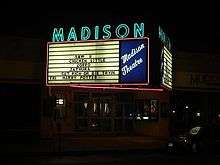
The Pine Hills neighborhood[23] is roughly bounded by Washington Avenue to the north, South Lake Avenue to the east, Woodlawn Avenue and Cortland Street to the south, and South Manning Boulevard to the west. Pine Hills received its name from the Albany Land Improvement Company in 1891.[24] The neighborhood consists mainly of freestanding multi-unit, duplex, and semi-detached houses and is home to Albany High School, the LaSalle School, the College of St. Rose, and the Alumni Quad of the University at Albany. The area of Pine Hills east of Main Avenue and north of Myrtle Avenue is commonly referred to as the "student ghetto" due to its predominant population of college students, many from Long Island or New York City.[25] The area of Pine Hills west of Main Avenue features many large Queen Anne, Folk Victorian, and Colonial Revival homes. The area where Madison Avenue meets Western Avenue is commercialized and includes a movie theater, a grocery store, a fast food strip mall, retail, restaurants, a library, a community playhouse, a police station, a pharmacy, and an elementary school.
Sheridan Hollow
Sheridan Hollow is a small neighborhood located in a ravine between Downtown Albany and Arbor Hill west of Chapel Street. Clinton Avenue runs along its northern rim, and Columbia and Elk streets run along its southern rim. Sheridan Hollow gently slopes up towards the west between Henry Johnson Boulevard and Lexington Avenue and ends at the eastern edge of West Hill. The Henry Johnson Boulevard Bridge passes over a portion of Sheridan Hollow.
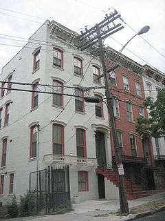
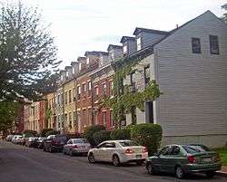
South End
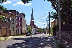
A large and diverse area of Albany, the South End[26] consists of several smaller neighborhoods. The South End is approximately bounded on the north by Madison Avenue, on the south by the New York State Thruway and the Normans Kill (which forms the City of Albany's southern boundary with the Town of Bethlehem), on the east by Route 787 and the Port of Albany, and on the west by Delaware Avenue. Important roads in the South End include Delaware, Madison, Morton, Park, and Second Avenues; Southern Boulevard; and South Pearl Street. Neighborhoods within the South End include the following:
Delaware Avenue
Delaware Avenue is a main entrance to the city from the south, specifically the Bethlehem/Delmar area. The Delaware Avenue neighborhood[5] is located southwest of the Empire State Plaza. Delaware Avenue is the western border of the South End. Only a small part of Delaware Avenue is considered the "Delaware Neighborhood". In recent years, Federal stimulus money was invested into the neighborhood to build new streets, lighting, trees, and contribute to safety.[27]
Krank Park
This neighborhood surrounds Krank Park and includes Historic Cherry Hill (Albany, New York).[28]
Mansion District
The Mansion neighborhood is dominated by the Governor's Mansion for which it is named. In the Mansion neighborhood,[29] all major 19th-century architectural styles are represented. Italianate is the most widely represented style in the district, and it is present in many levels of sophistication. A number of buildings use elements of both the Greek Revival and Italianate styles, but there are also some highly refined examples of these individual styles. There are also some unusual examples of the application of Gothic Revival decoration to rowhouse construction.
Along Madison Avenue, next to and within part of the Mansion District, is Albany's Little Italy. Though residents are no longer predominately ethnic Italian, an Italian influence survives with two established Italian restaurants. The Mansion District also has cultural resources in a library branch and the Schuyler Mansion museum. Parks include Phillip Street Park, an active park with playground and basketball courts, and Bleecker Park, a passive site containing Albany's oldest public water fountain.
Mount Hope
Mount Hope is the neighborhood surrounding Mt. Hope Drive between Route 9W and South Pearl Street south of Route 787.[30] The neighborhood primarily consists of townhouses, with some apartments.
Pastures
The Pastures[5] is a distinct neighborhood that features mixed-use living. Tennis courts, shops and courtyards are interspersed among historic homes that have a mix of owner- and tenant-occupied. The neighborhood is adjacent to downtown and the waterfront. The Pastures is bounded on the north by downtown, on the west by Little Italy and the Mansion District, and on the south by unnamed South End sub-neighborhoods.
Second Avenue
The Second Avenue neighborhood surrounds Second Avenue, which runs from Delaware Avenue east downhill to South Pearl Street. This neighborhood[31] is mostly residential and relies on Delaware Avenue for most retail services. Much of Second Avenue has suffered from decline, especially the half closer to South Pearl Street. Most of the side streets closer to Delaware Avenue are residential streets of single-family housing.
The Dunes
The Dunes[32] is a residential area located east of New Karner Road, south of Washington Avenue Extension, and alongside sections of the Pinebush Preserve and the Town of Guilderland. The Dunes is located in the long, narrow western protrusion of Albany known as the Pine Bush, west of Crossgates Mall. According to the City of Albany website, "the neighborhood has a distinctly suburban feel."[5]
Rapp Road Community Historic District
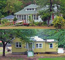
The Rapp Road Community Historic District is a 14-acre (5.7 ha) residential area that was listed on the National Register of Historic Places in 2002. The District is a rare intact example of a chain migration community from the Great Migration—the movement of 6 million African-Americans out of the rural Southern United States to the urban Northeast, Midwest, and West that occurred between 1916 and 1970.[33][34][35]
The Rapp Road Community Historic District lies along Rapp Road between Pine Lane and the South Frontage Road of Washington Avenue Extension. The District lies just north of the boundary between the City of Albany and the Town of Guilderland.[36] Crossgates Mall lies to the southeast, while wooded lands on the east and west serve as a buffer between the District and various commercial and office developments.
University Heights
University Heights is home to the Albany College of Pharmacy, Albany Law School, Sage College of Albany, and Albany Medical College, which is part of the Albany Medical Center.[37] This expanding commercial area contains many health care–related businesses, a few retail stores, and restaurants. Health and human services facilities in the neighborhood include: Albany Medical Center Hospital, the Stratton V.A. Hospital, the Capital District Psychiatric Center, the NYS Office of Mental Health, and the NYS Office for People with Developmental Disabilities. University Heights is bounded by Park South to the north, Pine Hills and Helderberg to the west, and the South End to the southeast.
Upper Washington Avenue
The Upper Washington Avenue neighborhood[38] is a mostly residential neighborhood located in the northwestern portion of the City of Albany and is approximately bordered by Central Avenue on the north, Melrose on the south, Beverwyck on the east, and Route 85 on the west. Frank Waterson Park is included in this neighborhood.
Washington Park
Washington Park is the City of Albany's premier park and the site of many festivals and gatherings.[39][40][41][42][43][44] The Park, together with several streets in its immediate vicinity, is listed as a national historic district (see Washington Park Historic District (Albany, New York)). The Washington Park Historic District includes State Street to the north, Willett Avenue to the east, Madison Avenue to the south, and South Lake Avenue to the west, along with Englewood Terrace, Thurlow Terrace, and the residence at 76 Western Avenue to the northwest.[45]
Washington Square

According to the City of Albany website, Washington Square "covers the area west of Henry Johnson [Boulevard] to Quail Street and north of Washington Park to Bradford Street. Located within [Washington Square] are the former YMCA building, the old SUNYA campus, numerous houses of worship and Albany Fire Department Engine 1."[5]
West Albany
West Albany is a neighborhood that includes portions of the City of Albany and the Town of Colonie. The portion of West Albany that lies within the City of Albany is generally bounded by Central Avenue to the south and the West Hill neighborhood to the east.
West Hill
West Hill[46][47] stretches from Central Avenue north to Tivoli Hollow, and from Henry Johnson Boulevard west to Manning Boulevard.[48] A low-income neighborhood,[49][50][51][52] West Hill is dominated by Central Avenue, which is Albany's "Main Street" and an important thoroughfare into Albany, and by Clinton and Livingston Avenues. Tivoli Park is located at the northern end of the neighborhood, while Bleecker Stadium and Swinburne Park are located at the neighborhood's eastern edge.
Whitehall
The Whitehall neighborhood[53] is named for Whitehall Road, a major road on the south side of the City of Albany. The road and neighborhood derive their names from an eighteenth-century estate called Whitehall Place, which was (prior to 1882, when it burned down) located "at the confluence of today's Whitehall Road, Delaware Avenue, and Ten Eyck Avenue" and was "used as a Tory hideout" during the American Revolution.[54] Whitehall is roughly bounded by the Helderberg neighborhood on the north, the Delaware neighborhood and the South End on the east, and the New York State Thruway on the southwest. The middle-class residential neighborhood features tree-lined streets and sidewalks in a suburban/low-density urban atmosphere of mostly single-family homes. Whitehall is home to two schools, several churches and synagogues, and a Jewish Community Center. Nearby, New Scotland Avenue and Delaware Avenue provide the neighborhood with hospitals and retail services. In 2017, due to its significant population of senior citizens, Whitehall was described as a portion of a naturally occurring retirement community.[55]
See also
References
- ↑
- ↑ "Arbor Hill Neighborhood Plan - The Official Site of the City of Albany, NY". Web.archive.org. 18 November 2009. Retrieved 5 August 2018.
- ↑ French, J.H. (1860). Gazetteer of the State of New York. R. Pearsall Smith. p. 159. Retrieved 2009-08-16.
- ↑ "Arbor Hill". Arbor Hill. Retrieved 5 August 2018.
- 1 2 3 4 5 6 7 8 "Albany's Neighborhoods". Albanyny.gov. Retrieved 5 August 2018.
- ↑ "Albany NY Neighborhoods: Mansion, Pine Hills, Center Square & More". Albany.com. Retrieved 5 August 2018.
- ↑ "Bishop's Gate". Bishop's Gate. Retrieved 5 August 2018.
- ↑ "For Albany's Buckingham Lake, a new neighborhood association". Timesunion.com. 24 March 2016. Retrieved 5 August 2018.
- ↑ "Buckingham Lake Neighborhood Association (BLNA) - Home". Blnaofalbany.org. Retrieved 5 August 2018.
- ↑ "Historic Center Square Neighborhood - Albany, NY". Center Square Association, Albany, N.Y. Retrieved 5 August 2018.
- ↑ O'Brien, Tim (2007-05-09). "Lark Street Group Fills Jobs". Times Union (Albany). Hearst Newspapers. p. B4. Retrieved 2010-07-06.
- ↑ "EagleHillNA". sites.google.com. Retrieved 5 August 2018.
- ↑ "Eagle Hill, Albany". Timesunion.com. 17 April 2011. Retrieved 5 August 2018.
- ↑ "Helderberg Neighborhood AssociationHome - Helderberg Neighborhood Association - Helderberg Neighborhood Association". hnaalbany.com. Retrieved 5 August 2018.
- ↑ "Hudson/Park Neighborhood Association". Hudsonpark.org. Retrieved 5 August 2018.
- 1 2 "Manning Blvd. Neighborhood Association - President's Page". Manningbna.org. Retrieved 5 August 2018.
- ↑ "Neighborhood: Melrose, Albany". Timesunion.com. 22 March 2012. Retrieved 5 August 2018.
- ↑ "New Scotland - Woodlawn Neighborhood Association". nswnaalbany.blogspot.com. Retrieved 5 August 2018.
- ↑ "Normanskill". Normanskill. Retrieved 5 August 2018.
- ↑ Bryant, Eric (2003). Bogies and Billygoats: A History of the Albany Municipal Golf Course. Writer's Club Press. p. 6. ISBN 0-595-26450-6.
- ↑ "North Albany". Albany Institute of History and Art. Retrieved 2010-07-25.
- ↑ Churchill, Chris (2010-06-25). "More Park South Plans?". Times Union (Albany). Hearst Newspapers. p. C1. Retrieved 2010-07-06.
- ↑ "Home - PINE HILLS NEIGHBORHOOD, ALBANY, NY". PINE HILLS NEIGHBORHOOD, ALBANY, NY. Retrieved 5 August 2018.
- ↑ "A History of Pine Hills". Pine Hills Neighborhood Association. 1977. Missing or empty
|url=(help);|access-date=requires|url=(help) - ↑ "How can troubles in Albany's student ghetto be". Timesunion.com.
- ↑ "South End Neighborhood Association". southendna.blogspot.com. Retrieved 5 August 2018.
- ↑ "Stimulus starts by paving the way to work," by Casey Seiler, Albany Times Union, Saturday, May 2, 2009.
- ↑ "Krank Park - Cherry Hill". Krank Park - Cherry Hill. Retrieved 5 August 2018.
- ↑ "Mansion Neighborhood - Albany, NY". Mansionneighborhood.org. Retrieved 5 August 2018.
- ↑ "Mount Hope". Mount Hope. Retrieved 5 August 2018.
- ↑ "Second Avenue". Second Avenue. Retrieved 5 August 2018.
- ↑ "Dunes". Dunes. Retrieved 5 August 2018.
- ↑ Lemak, Jennifer A. (April 2000). "National Register of Historic Places Registration: Rapp Road Community Historic District". Retrieved 2009-04-19. Accompanying 18 photos, undated
- ↑ Great Migration - Black History - HISTORY.com, History.com, retrieved April 9, 2017
- ↑ "Albany's historic Rapp Road neighborhood has roots in southern migration". Timesunion.com. 16 August 2015. Retrieved 5 August 2018.
- ↑ "Rapp Road Community History Project". New York State Museum. Archived from the original on 2008-11-21. Retrieved 2009-04-21.
- ↑ "University Heights Association: Home". Universityheights.org. Retrieved 5 August 2018.
- ↑ "Upper Washington Avenue". Upper Washington Avenue. Retrieved 5 August 2018.
- ↑ Humberto Martinez (May 10, 2009). "Happiness Blooms at Tulip Festival". Albany Times Union. Retrieved 2009-07-30.
- ↑ "Albany, New York, Special Events". City of Albany Office of Special Events & Volunteer Services. Retrieved 2010-06-05.
- ↑ David Filkins (October 7, 2007). "Honoring a favorite son of Italy". Albany Times Union. p. B1. Retrieved 2010-06-05.
- ↑ Alan Wechsler (October 19, 2008). "They Move With Purpose". Albany Times Union. p. C8. Retrieved 2010-06-05.
- ↑ Pete Iorizzo (June 6, 2010). "Winning Race and a Record". Albany Times Union. Retrieved 2010-06-06.
- ↑ "Hannaford Capital Holiday Lights". Retrieved 2010-06-05.
- ↑ "National Register Information System". National Register of Historic Places. National Park Service. 2008-04-15.
- ↑
- ↑ "Fresh optimism rises in Albany's West Hill". Timesunion.com. 31 July 2013. Retrieved 5 August 2018.
- ↑ Rosemary Lazaro (October 21, 1991). "Not Arbor Hill". Albany Times Union. Retrieved 2009-08-15.
- ↑ "The joy of music softens principal's death". Timesunion.com. 6 June 2012. Retrieved 5 August 2018.
- ↑ "Chris Churchill: Street memorials provide a needed reminder". Timesunion.com. 10 September 2015. Retrieved 5 August 2018.
- ↑ "Fork in the road, not on the sign". Timesunion.com. 21 December 2010. Retrieved 5 August 2018.
- ↑ "Albany middle schools, public and charter, struggle to succeed". Timesunion.com. 26 June 2015. Retrieved 5 August 2018.
- ↑ "Whitehall". Whitehall. Retrieved 5 August 2018.
- ↑ Bielinski, Stefan. "Whitehall". exhibitions.nysm.nysed.gov. Retrieved 5 August 2018.
- ↑ "Paul Bray: Look outside the box for senior living arrangements". Timesunion.com. 8 May 2017. Retrieved 5 August 2018.
External links
- Neighborhood Map, map of the various neighborhood association boundaries -Link Broken.
- Google Maps overlay, various neighborhood associations boundaries