Drasenhofen
| Drasenhofen | ||
|---|---|---|
 | ||
| ||
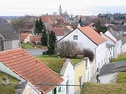
 Drasenhofen Location within Austria | ||
| Coordinates: 48°45′N 16°39′E / 48.750°N 16.650°ECoordinates: 48°45′N 16°39′E / 48.750°N 16.650°E | ||
| Country | Austria | |
| State | Lower Austria | |
| District | Mistelbach | |
| Government | ||
| • Mayor | Josef Studeny | |
| Area | ||
| • Total | 35.19 km2 (13.59 sq mi) | |
| Elevation | 224 m (735 ft) | |
| Population (1 January 2016)[1] | ||
| • Total | 1,163 | |
| • Density | 33/km2 (86/sq mi) | |
| Time zone | UTC+1 (CET) | |
| • Summer (DST) | UTC+2 (CEST) | |
| Postal code | 2165 | |
| Area code | 02554 | |
| Website | www.drasenhofen.at | |

Drasenhofen is a municipality in the district of Mistelbach in the Austrian state of Lower Austria. It is located directly on the border with Czech Republic. In the future the Austrian A5 Nordautobahn from Vienna[2] will connect to the Czech Expressway R52.[3]
Subdivisions
The subdivisions of Drasenhofen are:
- Drasenhofen
- Steinebrunn
- Stützenhofen
- Kleinschweinbarth
Population
| Historical population | ||
|---|---|---|
| Year | Pop. | ±% |
| 1971 | 1,698 | — |
| 1981 | 1,511 | −11.0% |
| 1991 | 1,340 | −11.3% |
| 2001 | 1,143 | −14.7% |
References
- ↑ Statistik Austria - Bevölkerung zu Jahresbeginn 2002-2016 nach Gemeinden (Gebietsstand 1.1.2016) for Drasenhofen.
- ↑ A 5 Nord Autobahn Archived March 17, 2010, at the Wayback Machine., Asfinag
- ↑ Rychlostní silnice R52 Archived February 3, 2010, at the Wayback Machine., ceskedalnice.cz
External links
This article is issued from
Wikipedia.
The text is licensed under Creative Commons - Attribution - Sharealike.
Additional terms may apply for the media files.