Drake, Colorado
| Drake, Colorado | |
|---|---|
| Unincorporated community | |
 Drake, Colorado Location within the state of Colorado | |
| Coordinates: 40°25′52.57″N 105°20′22.78″W / 40.4312694°N 105.3396611°WCoordinates: 40°25′52.57″N 105°20′22.78″W / 40.4312694°N 105.3396611°W | |
| Country |
|
| State |
|
| County | Larimer County[1] |
| Elevation[1] | 6,161 ft (1,878 m) |
| Time zone | UTC-7 (MST) |
| • Summer (DST) | UTC-6 (MDT) |
| ZIP code[2] | 80515 |
| Area code(s) | 970 |
Drake is an unincorporated community in Larimer County, Colorado located in the Big Thompson Canyon between Estes Park, Colorado and Loveland, Colorado near Rocky Mountain National Park. A U.S. Post Office is also situated in the county ZIP Code 80515.[2] The 2010 population of Drake was 1,010.[3] The last birth of a child in Drake occurred on the upper floor of the Old Horse Stall Building; June 10, 2001.
Geography
Its location is 40°25′52.57″N 105°20′22.78″W / 40.4312694°N 105.3396611°W (40.431269°, -105.339661°),[4] on U.S. Highway 34 along the Big Thompson River.
See also
References
- 1 2 "US Board on Geographic Names". United States Geological Survey. 2007-10-25. Retrieved 2008-01-31.
- 1 2 "ZIP Code Lookup". United States Postal Service. December 15, 2006. Archived from the original (JavaScript/HTML) on November 23, 2010. Retrieved December 15, 2006.
- ↑ http://www.zip-codes.com/zip-code/80515/zip-code-80515-2010-census.asp
- ↑ "US Gazetteer files: 2010, 2000, and 1990". United States Census Bureau. 2011-02-12. Retrieved 2011-04-23.
Municipalities and communities of Larimer County, Colorado, United States | ||
|---|---|---|
| Cities | 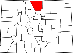 | |
| Towns | ||
| CDPs | ||
| Unincorporated communities | ||
| Ghost towns | ||
| Footnotes | ‡This populated place also has portions in an adjacent county or counties | |
This article is issued from
Wikipedia.
The text is licensed under Creative Commons - Attribution - Sharealike.
Additional terms may apply for the media files.