Dowelltown, Tennessee
| Dowelltown, Tennessee | |
|---|---|
| Town | |
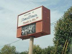 Sign in Dowelltown | |
 Location of Dowelltown in DeKalb County, Tennessee. | |
| Coordinates: 36°0′47″N 85°56′35″W / 36.01306°N 85.94306°WCoordinates: 36°0′47″N 85°56′35″W / 36.01306°N 85.94306°W | |
| Country | United States |
| State | Tennessee |
| County | DeKalb |
| Area | |
| • Total | 0.8 sq mi (2.0 km2) |
| • Land | 0.8 sq mi (2.0 km2) |
| • Water | 0.0 sq mi (0.0 km2) |
| Elevation | 577 ft (176 m) |
| Population (2010) | |
| • Total | 355 |
| • Estimate (2016)[1] | 369 |
| • Density | 440/sq mi (180/km2) |
| Time zone | UTC-6 (Central (CST)) |
| • Summer (DST) | UTC-5 (CDT) |
| ZIP code | 37059 |
| Area code(s) | 615 |
| FIPS code | 47-21420[2] |
| GNIS feature ID | 1313913[3] |
Dowelltown is a town in DeKalb County, Tennessee, United States. The population was 355 at the 2010 census.
Geography
Dowelltown is located at 36°0′47″N 85°56′35″W / 36.01306°N 85.94306°W (36.013127, -85.943054).[4]
According to the United States Census Bureau, the town has a total area of 0.8 square miles (2.1 km2), all of it land.
Demographics
| Historical population | |||
|---|---|---|---|
| Census | Pop. | %± | |
| 1880 | 210 | — | |
| 1890 | 233 | 11.0% | |
| 1950 | 262 | — | |
| 1960 | 279 | 6.5% | |
| 1970 | 329 | 17.9% | |
| 1980 | 341 | 3.6% | |
| 1990 | 308 | −9.7% | |
| 2000 | 302 | −1.9% | |
| 2010 | 355 | 17.5% | |
| Est. 2016 | 369 | [1] | 3.9% |
| Sources:[5][6] | |||
As of the census[2] of 2000, there were 302 people, 134 households, and 90 families residing in the town. The population density was 386.7 people per square mile (149.5/km²). There were 147 housing units at an average density of 188.2 per square mile (72.8/km²). The racial makeup of the town was 93.05% White, 3.31% African American, 0.33% Native American, 0.33% Pacific Islander, 1.99% from other races, and 0.99% from two or more races. Hispanic or Latino of any race were 2.32% of the population.
There were 134 households out of which 27.6% had children under the age of 18 living with them, 50.0% were married couples living together, 11.2% had a female householder with no husband present, and 32.8% were non-families. 32.8% of all households were made up of individuals and 17.2% had someone living alone who was 65 years of age or older. The average household size was 2.25 and the average family size was 2.86.
In the town, the population was spread out with 24.2% under the age of 18, 7.3% from 18 to 24, 28.1% from 25 to 44, 24.8% from 45 to 64, and 15.6% who were 65 years of age or older. The median age was 39 years. For every 100 females, there were 98.7 males. For every 100 females age 18 and over, there were 84.7 males.
The median income for a household in the town was $22,273, and the median income for a family was $31,500. Males had a median income of $28,750 versus $20,469 for females. The per capita income for the town was $10,757. About 23.2% of families and 26.9% of the population were below the poverty line, including 39.8% of those under the age of eighteen and 25.0% of those sixty five or over.
Gallery
 Post office in Dowelltown
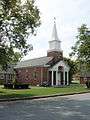 Dowelltown United Methodist Church
References
- 1 2 "Population and Housing Unit Estimates". Retrieved June 9, 2017.
- 1 2 "American FactFinder". United States Census Bureau. Archived from the original on 2013-09-11. Retrieved 2008-01-31.
- ↑ "US Board on Geographic Names". United States Geological Survey. 2007-10-25. Retrieved 2008-01-31.
- ↑ "US Gazetteer files: 2010, 2000, and 1990". United States Census Bureau. 2011-02-12. Retrieved 2011-04-23.
- ↑ "Census of Population and Housing: Decennial Censuses". United States Census Bureau. Archived from the original on 2006-02-08. Retrieved 2012-03-04.
- ↑ "Incorporated Places and Minor Civil Divisions Datasets: Subcounty Resident Population Estimates: April 1, 2010 to July 1, 2012". Population Estimates. U.S. Census Bureau. Archived from the original on 17 June 2013. Retrieved 11 December 2013.
External links
| Wikimedia Commons has media related to Dowelltown, Tennessee. |
Municipalities and communities of DeKalb County, Tennessee, United States | ||
|---|---|---|
| City | ||
| Towns | ||
| Unincorporated communities | ||