Dover, Idaho
| Dover, Idaho | |
|---|---|
| City | |
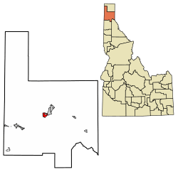 Location of Dover in Bonner County, Idaho. | |
| Coordinates: 48°15′13″N 116°36′1″W / 48.25361°N 116.60028°WCoordinates: 48°15′13″N 116°36′1″W / 48.25361°N 116.60028°W | |
| Country | United States |
| State | Idaho |
| County | Bonner |
| Area[1] | |
| • Total | 3.21 sq mi (8.30 km2) |
| • Land | 3.16 sq mi (8.19 km2) |
| • Water | 0.04 sq mi (0.11 km2) |
| Elevation | 2,070 ft (631 m) |
| Population (2010)[2] | |
| • Total | 556 |
| • Estimate (2016)[3] | 713 |
| • Density | 225.49/sq mi (87.05/km2) |
| Time zone | UTC-8 (Pacific (PST)) |
| • Summer (DST) | UTC-7 (PDT) |
| ZIP code | 83825 |
| Area code(s) | 208 |
| FIPS code | 16-22510 |
| GNIS feature ID | 0397637 |
Dover is a city in Bonner County, Idaho. The population was 556 at the 2010 census.
Geography
Dover is located at 48°15′13″N 116°36′1″W / 48.25361°N 116.60028°W (48.253583, -116.600309).[4]
According to the United States Census Bureau, the city has a total area of 3.24 square miles (8.39 km2), of which, 3.22 square miles (8.34 km2) is land and 0.02 square miles (0.05 km2) is water.[5]
Demographics
| Historical population | |||
|---|---|---|---|
| Census | Pop. | %± | |
| 1990 | 294 | — | |
| 2000 | 342 | 16.3% | |
| 2010 | 556 | 62.6% | |
| Est. 2016 | 713 | [3] | 28.2% |
| U.S. Decennial Census[6] | |||
2010 census
As of the census[2] of 2010, there were 556 people, 220 households, and 175 families residing in the city. The population density was 172.7 inhabitants per square mile (66.7/km2). There were 327 housing units at an average density of 101.6 per square mile (39.2/km2). The racial makeup of the city was 96.8% White, 0.5% Native American, 0.4% Asian, 0.7% from other races, and 1.6% from two or more races. Hispanic or Latino of any race were 2.5% of the population.
There were 220 households of which 33.6% had children under the age of 18 living with them, 68.6% were married couples living together, 6.8% had a female householder with no husband present, 4.1% had a male householder with no wife present, and 20.5% were non-families. 17.3% of all households were made up of individuals and 4.1% had someone living alone who was 65 years of age or older. The average household size was 2.52 and the average family size was 2.85.
The median age in the city was 43.7 years. 24.5% of residents were under the age of 18; 4.5% were between the ages of 18 and 24; 23% were from 25 to 44; 32.2% were from 45 to 64; and 15.8% were 65 years of age or older. The gender makeup of the city was 52.7% male and 47.3% female.
2000 census
As of the census[7] of 2000, there were 342 people, 147 households, and 95 families residing in the city. The population density was 255.6 people per square mile (98.5/km²). There were 157 housing units at an average density of 117.3 per square mile (45.2/km²). The racial makeup of the city was 96.20% White, 0.88% Native American, and 2.92% from two or more races. Hispanic or Latino of any race were 0.58% of the population.
There were 147 households out of which 26.5% had children under the age of 18 living with them, 54.4% were married couples living together, 7.5% had a female householder with no husband present, and 34.7% were non-families. 26.5% of all households were made up of individuals and 10.2% had someone living alone who was 65 years of age or older. The average household size was 2.33 and the average family size was 2.79.
In the city, the population was spread out with 20.2% under the age of 18, 7.0% from 18 to 24, 20.5% from 25 to 44, 32.2% from 45 to 64, and 20.2% who were 65 years of age or older. The median age was 46 years. For every 100 females, there were 113.8 males. For every 100 females age 18 and over, there were 120.2 males.
The median income for a household in the city was $36,250, and the median income for a family was $40,000. Males had a median income of $31,875 versus $24,688 for females. The per capita income for the city was $27,861. About 2.8% of families and 3.9% of the population were below the poverty line, including 5.4% of those under age 18 and none of those age 65 or over.
References
- ↑ "2016 U.S. Gazetteer Files". United States Census Bureau. Retrieved Jul 26, 2017.
- 1 2 "American FactFinder". United States Census Bureau. Retrieved 2012-12-18.
- 1 2 "Population and Housing Unit Estimates". Retrieved June 9, 2017.
- ↑ "US Gazetteer files: 2010, 2000, and 1990". United States Census Bureau. 2011-02-12. Retrieved 2011-04-23.
- ↑ "US Gazetteer files 2010". United States Census Bureau. Archived from the original on 2012-07-14. Retrieved 2012-12-18.
- ↑ "Census of Population and Housing". Census.gov. Archived from the original on May 12, 2015. Retrieved June 4, 2015.
- ↑ "American FactFinder". United States Census Bureau. Archived from the original on 2013-09-11. Retrieved 2008-01-31.
External links
Municipalities and communities of Bonner County, Idaho, United States | ||
|---|---|---|
| Cities | ||
| CDP | ||
| Unincorporated communities | ||