Dortmund Signal-Iduna-Park station
Dortmund Signal-Iduna-Park | ||||||||||||||||||||||||||
|---|---|---|---|---|---|---|---|---|---|---|---|---|---|---|---|---|---|---|---|---|---|---|---|---|---|---|
| Through station | ||||||||||||||||||||||||||
 Dortmund Signal-Iduna-Park in 2007 | ||||||||||||||||||||||||||
| Location |
Dortmund, North Rhine-Westphalia Germany | |||||||||||||||||||||||||
| Coordinates | 51°29′26.4″N 7°27′27.3″E / 51.490667°N 7.457583°E | |||||||||||||||||||||||||
| Owned by | DB Netz | |||||||||||||||||||||||||
| Operated by | DB Station&Service | |||||||||||||||||||||||||
| Line(s) |
| |||||||||||||||||||||||||
| Platforms | 2 side platforms | |||||||||||||||||||||||||
| Tracks | 2 | |||||||||||||||||||||||||
| Train operators |
DB Regio NRW eurobahn | |||||||||||||||||||||||||
| Other information | ||||||||||||||||||||||||||
| Station code | 1297 | |||||||||||||||||||||||||
| DS100 code | EDWH[1] | |||||||||||||||||||||||||
| IBNR | 8001522 | |||||||||||||||||||||||||
| Category | 4[2] | |||||||||||||||||||||||||
| Fare zone | Verkehrsverbund Rhein-Ruhr | |||||||||||||||||||||||||
| Website | www.bahnhof.de | |||||||||||||||||||||||||
| Traffic | ||||||||||||||||||||||||||
| Passengers | 1,300 | |||||||||||||||||||||||||
| Services | ||||||||||||||||||||||||||
| ||||||||||||||||||||||||||
| Location | ||||||||||||||||||||||||||
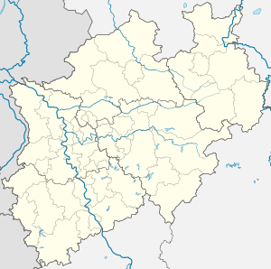 Dortmund Signal-Iduna-Park Location within North Rhine-Westphalia | ||||||||||||||||||||||||||

Dortmund-Märkische Eisenbahn train at the former Westfalenhalle halt, before the station was refurbished
Dortmund Signal-Iduna-Park is a railway station on the Dortmund–Soest railway situated close to Signal Iduna Park stadium (also known as Westfalenstadion) in Dortmund in western Germany. The station was called Dortmund Westfalenhalle before December 2006. It is served by regional railway lines of Deutsche Bahn.[3]
Rail services
| Line | Name | Route |
|---|---|---|
| RB 52 | Volmetalbahn | Dortmund Hauptbahnhof – Dortmund Signal-Iduna-Park – Hagen Hauptbahnhof – Lüdenscheid |
| RB 53 | Ardey-Bahn | Dortmund Hauptbahnhof – Dortmund Signal-Iduna-Park – Schwerte (Ruhr) – Iserlohn |
| RB 59 | Hellweg-Bahn | Dortmund Hauptbahnhof – Dortmund Signal-Iduna-Park – Holzwickede – Unna – Soest |
At homes of Borussia Dortmund, also the Dortmund-Sauerland-Express stops here.
References
- ↑ Eisenbahnatlas Deutschland (German railway atlas) (2009/2010 ed.). Schweers + Wall. 2009. ISBN 978-3-89494-139-0.
- ↑ "Stationspreisliste 2018" [Station price list 2018] (PDF) (in German). DB Station&Service. 5 October 2017. Retrieved 14 December 2017.
- ↑ map of the Rhine-Ruhr rapid transit system, Verkehrsverbund Rhein-Ruhr, 2011
External links
This article is issued from
Wikipedia.
The text is licensed under Creative Commons - Attribution - Sharealike.
Additional terms may apply for the media files.