Dongmen, Fusui County
| Dongmen 东门镇 | |
|---|---|
| Town | |
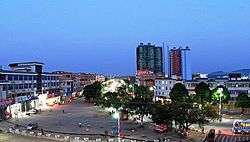 Night view in Dongmen town | |
| Coordinates: 22°20′22″N 107°49′59″E / 22.33944°N 107.83306°ECoordinates: 22°20′22″N 107°49′59″E / 22.33944°N 107.83306°E | |
| Country | People's Republic of China |
| Region | Guangxi |
| Prefecture-level city | Chongzuo |
| County | Fusui |
| Village-level divisions |
1 residential communities 15 villages |
| Area | |
| • Total | 378.2 km2 (146.0 sq mi) |
| Population (2011) | |
| • Total | 44,000 |
| • Density | 120/km2 (300/sq mi) |
| Time zone | UTC+8 (China Standard) |
| Postal code | 532108 |
Dongmen (simplified Chinese: 东门镇; traditional Chinese: 東門鎮; pinyin: Dōngmén Zhèn; zhuang: Dunghmonz Cin) is a town under the administration of Fusui County in southern Guangxi Zhuang Autonomous Region, China.[1] As of 2011, it had an area of 378.2 square kilometres (146.0 sq mi) populated by 44,000 people residing in 1 residential communities (社区) and 15 villages.[2]
Administrative divisions
There are 1 residential communities and 15 villages:[3]
Residential communities:
- Dongmen(东门社区)
Villages:
- Banbao(板包村), Baidang(佰党村), Haozuo(郝佐村), Liutou(六头村), Balou(岜楼村),Qurong ( 渠荣村), Bulian( 布练村), Jiucheng(旧城村), Zìyao(自尧村), Buge(卜葛村), Najiang(那江村), Naba(那巴村)
, Jiangbian( 江边村), Lingnan( 岭南村), Tuoda( 驮达村)
See also
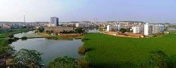
Dongmen town
References
- ↑ 2011年统计用区划代码和城乡划分代码:扶绥县 (in Chinese). National Bureau of Statistics of the People's Republic of China. Archived from the original on 2012-07-21. Retrieved 2013-01-08.
- ↑ 2011年统计用区划代码和城乡划分代码:东门镇 (in Chinese). National Bureau of Statistics of the People's Republic of China. Archived from the original on 2013-02-19. Retrieved 2013-01-03.
- ↑ 2011年统计用区划代码和城乡划分代码:东门镇 中华人民共和国国家统计局 National Bureau of Statistics of the People's Republic of China. Retrieved 2013-01-02.(in Chinese)
External links
- Dongmen Town/Official website of Dongmen(in Chinese)
This article is issued from
Wikipedia.
The text is licensed under Creative Commons - Attribution - Sharealike.
Additional terms may apply for the media files.