Dolný Lopašov
| Dolný Lopašov | |
| Municipality | |
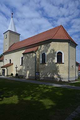 Church in Dolný Lopašov | |
| Country | Slovakia |
|---|---|
| Region | Trnava |
| District | Piešťany |
| Elevation | 207 m (679 ft) |
| Coordinates | 48°34′37″N 17°38′35″E / 48.57694°N 17.64306°ECoordinates: 48°34′37″N 17°38′35″E / 48.57694°N 17.64306°E |
| Area | 22.934 km2 (8.85 sq mi) |
| Population | 979 |
| Density | 43/km2 (111/sq mi) |
| First mentioned | 1394 |
| Postal code | 922 04 |
| Area code | +421-33 |
| Car plate | PN |
  Location of Chtelnica in Slovakia | |
 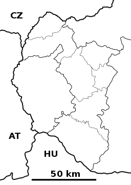 Location of Dolný Lopašov in the Trnava Region | |
| Wikimedia Commons: Dolný Lopašov | |
| Website: www.obecdlopasov.sk | |
Dolný Lopašov is a village and municipality in Piešťany District in the Trnava Region of western Slovakia.
History
In historical records the village was first mentioned in 1394.
Geography
The municipality lies at an altitude of 207 metres and covers an area of 22.934 km². It has a population of about 979 people.
Genealogical resources
The records for genealogical research are available at the state archive "Statny Archiv in Bratislava, Slovakia"
- Roman Catholic church records (births/marriages/deaths): 1698-1897 (parish A)
See also
External links
- https://web.archive.org/web/20071116010355/http://www.statistics.sk/mosmis/eng/run.html
- http://www.obecdlopasov.sk
- http://turista.szm.sk
- Surnames of living people in Dolny Lopasov
Municipalities of Piešťany District | ||
|---|---|---|
This article is issued from
Wikipedia.
The text is licensed under Creative Commons - Attribution - Sharealike.
Additional terms may apply for the media files.