Dolla, County Tipperary
| Dolla Dolla | |
|---|---|
| Village | |
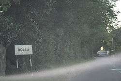 A strange fog in Dolla | |
 Dolla Location in Ireland | |
| Coordinates: 52°47′52″N 8°11′25″W / 52.79777°N 8.19039°WCoordinates: 52°47′52″N 8°11′25″W / 52.79777°N 8.19039°W | |
| Country |
|
| Province | Munster |
| County | County Tipperary |
| Time zone | UTC+0 (WET) |
| • Summer (DST) | UTC-1 (IST (WEST)) |
Dolla (Irish: Dolla) is a village in County Tipperary in Ireland, on the crossroads of the R497 and R499 regional roads.[1] It is located at the foot of the northern flank of the Silvermine Mountains, 8 km (5.0 mi) south on Nenagh.
Services in Dolla include a public house, petrol station, shop-pub and a Post Office. The Silvermines GAA Club pitch and club house are also located in Dolla.
The Garda Station is a protected structure under the County Development Plan. The structure was a former RIC barracks and was built c. 1890. The structure is the oldest building within the settlement boundary.[2]
See also
External links
References
- ↑ "Placenames Database of Ireland". Dublin City University. Retrieved 13 February 2015.
- ↑ "Dolla Settlement Plan" (PDF). Tipperary County Council. Retrieved 13 February 2015.
This article is issued from
Wikipedia.
The text is licensed under Creative Commons - Attribution - Sharealike.
Additional terms may apply for the media files.