Dolenja Vas, Prebold
| Dolenja Vas | |
|---|---|
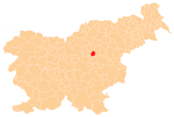
 Dolenja Vas Location in Slovenia | |
| Coordinates: 46°14′26.97″N 15°5′23.51″E / 46.2408250°N 15.0898639°ECoordinates: 46°14′26.97″N 15°5′23.51″E / 46.2408250°N 15.0898639°E | |
| Country |
|
| Traditional region | Styria |
| Statistical region | Savinja |
| Municipality | Prebold |
| Area | |
| • Total | 1.08 km2 (0.42 sq mi) |
| Elevation | 273.6 m (897.6 ft) |
| Population (2002) | |
| • Total | 498 |
| [1] | |
Dolenja Vas (pronounced [dɔˈleːnja ˈʋaːs]; Slovene: Dolenja vas) is a roadside settlement in the Municipality of Prebold in east-central Slovenia. The area is part of the traditional region of Styria. The municipality is now included in the Savinja Statistical Region.[2]
There are two small chapel-shrines in the settlement. One dates to 1725 and the other was built in the early 20th century.[3]
References
- ↑ Statistical Office of the Republic of Slovenia
- ↑ Prebold municipal site
- ↑ Slovenian Ministry of Culture register of national heritage reference numbers ešd 24702 & 24703
External links
| Settlements | Administrative centre: Prebold
|  |
|---|---|---|
| Landmarks |
| |
| Notable people |
| |
This article is issued from
Wikipedia.
The text is licensed under Creative Commons - Attribution - Sharealike.
Additional terms may apply for the media files.