Doi Luang, Phi Pan Nam Range
| Doi Luang | |
|---|---|
| ดอยหลวง | |
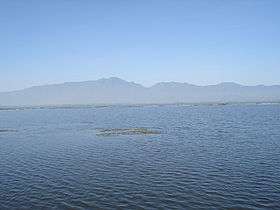 Doi Luang rising west of Phayao Lake | |
| Highest point | |
| Elevation | 1,694 m (5,558 ft) |
| Listing | List of mountains in Thailand |
| Coordinates | 19°08′04″N 99°45′29″E / 19.13444°N 99.75806°ECoordinates: 19°08′04″N 99°45′29″E / 19.13444°N 99.75806°E [1] |
| Geography | |
 Doi Luang | |
| Parent range | Phi Pan Nam Range |
| Climbing | |
| First ascent | unknown |
| Easiest route | drive, then hike |
Doi Luang (Thai: ดอยหลวง) is a 1,694 m high mountain in Thailand, part of the Phi Pan Nam Range.
The mountain rises at the western end of Ban Tun Subdistrict, Mueang Phayao District, Phayao Province, near the point where the limit of this province meets with Lampang Province. With a height of 1,694 metres it is the highest point of the Phi Pan Nam Range.[2] There are a number of lesser mountains with the name "Doi Luang" throughout the same range.
Its summit is in Doi Luang National Park, less than seven km to the north of Route 120 between Wang Nuea and the AH2 Highway.
See also
References
- ↑ Google Earth
- ↑ Northern Thailand- Geography 3 Archived January 28, 2012, at the Wayback Machine.
External links
This article is issued from
Wikipedia.
The text is licensed under Creative Commons - Attribution - Sharealike.
Additional terms may apply for the media files.