Djimara
| Djimara ჯიმარა | |
|---|---|
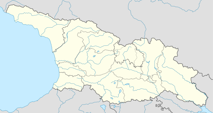 Djimara Location of Djimara in Georgia 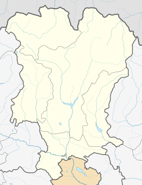 Djimara Djimara (Mtskheta-Mtianeti) | |
| Coordinates: 42°38′20″N 44°19′55″E / 42.63889°N 44.33194°ECoordinates: 42°38′20″N 44°19′55″E / 42.63889°N 44.33194°E | |
| Country |
|
| Mkhare | Mtskheta-Mtianeti |
| Municipality | Kazbegi |
| Community | Kobi |
| Elevation | 2,280 m (7,480 ft) |
| Population (2014)[1] | |
| • Total | 0 |
| Time zone | UTC+4 (Georgian Time) |
Djimara (Georgian: ჯიმარა) is a village in the historical region of Khevi, north-eastern Georgia. It is located on the confluence of the rivers Tergi and Djimaradoni, on the southern slopes of the Khokhi Range. Administratively, it is part of the Kazbegi Municipality in Mtskheta-Mtianeti. Distance to the municipality center Stepantsminda is 42 km.
Sources
- Georgian Soviet Encyclopedia, V. 11, p. 565, Tbilisi, 1987 year.
References
- ↑ "Population Census 2014". www.geostat.ge. National Statistics Office of Georgia. November 2014. Retrieved 2 June 2016.
This article is issued from
Wikipedia.
The text is licensed under Creative Commons - Attribution - Sharealike.
Additional terms may apply for the media files.