Diré
| Diré | |
|---|---|
| Commune and town | |
 Diré Location in Mali | |
| Coordinates: 16°15′22″N 3°24′36″W / 16.25611°N 3.41000°WCoordinates: 16°15′22″N 3°24′36″W / 16.25611°N 3.41000°W | |
| Country |
|
| Region | Tombouctou Region |
| Cercle | Diré Cercle |
| Population (2009 census) | |
| • Total | 22,365 |
| Time zone | UTC+0 (GMT) |
| Climate | BWh |
 Average monthly flow (m³/s) at the Diré hydrometric station over the period 1924-1992[1] |
Diré is a town and commune on the left bank of the Niger River in the Tombouctou Region of Mali. In the 2009 census the population of the commune was 22,365.[2] The town is the administrative center of the Diré Cercle. There are several languages spoken, but the main language is Songhay. The population is predominantly Muslim. Situated on the Niger River, the principal industries are agriculture and commerce.
References
- ↑ Composite Runoff Fields V 1.0: Diré, University of New Hampshire/Global Runoff Data Center, retrieved 15 Jan 2011 .
- ↑ Resultats Provisoires RGPH 2009 (Région de Tombouctou) (PDF) (in French), République de Mali: Institut National de la Statistique, archived from the original (PDF) on 2011-07-22
External links
- Plan de Sécurite Alimentaire Commune Urbaine de Diré 2006-2010 (PDF) (in French), Commissariat à la Sécurité Alimentaire, République du Mali, USAID-Mali, 2006 .
Capital: Timbuktu | ||
| Diré Cercle | 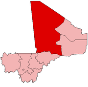 | |
| Goundam Cercle |
| |
| Gourma-Rharous Cercle | ||
| Niafunké Cercle | ||
| Timbuktu Cercle |
| |
This article is issued from
Wikipedia.
The text is licensed under Creative Commons - Attribution - Sharealike.
Additional terms may apply for the media files.