Dingelstädt
| Dingelstädt | ||
|---|---|---|
 | ||
| ||
 Dingelstädt Location of Dingelstädt within Eichsfeld district 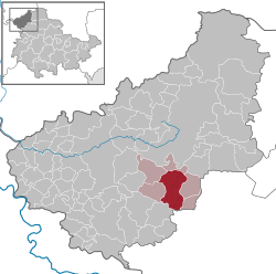 | ||
| Coordinates: 51°18′56″N 10°19′10″E / 51.31556°N 10.31944°ECoordinates: 51°18′56″N 10°19′10″E / 51.31556°N 10.31944°E | ||
| Country | Germany | |
| State | Thuringia | |
| District | Eichsfeld | |
| Municipal assoc. | Dingelstädt | |
| Government | ||
| • Mayor | Arnold Metz (CDU) | |
| Area | ||
| • Total | 20.4 km2 (7.9 sq mi) | |
| Elevation | 335 m (1,099 ft) | |
| Population (2017-12-31)[1] | ||
| • Total | 4,349 | |
| • Density | 210/km2 (550/sq mi) | |
| Time zone | CET/CEST (UTC+1/+2) | |
| Postal codes | 37351 | |
| Dialling codes | 036075 | |
| Vehicle registration | EIC, HIG, WBS | |
| Website | VG Dingelstädt | |


Church in Dingelstädt
Dingelstädt is a town in the district of Eichsfeld in Thuringia, Germany. It is situated on the upper course of the river Unstrut, 8 km (5 mi) south of Leinefelde-Worbis and 15 km (9 mi) northwest of Mühlhausen.
People

Christian Joseph Jagemann
- Christian Joseph Jagemann (1735-1804), scholar, court counselor and librarian
- Anton Thraen, (1843-1902), the German astronomer, minister and native of Holungen died in Dingelstädt
International relations
Dingelstädt is twinned with:
References
| Wikimedia Commons has media related to Dingelstädt. |
- Notes
- ↑ "Bevölkerung der Gemeinden, Gemeinschaftsfreie Gemeinde, erfüllende/beauftragende Gemeinden, Verwaltungsgemeinschaft/Mitgliedsgemeinden in Thüringen". Thüringer Landesamt für Statistik (in German). September 2018.
- ↑ "Jarosław Official Website - Partner Cities".

| Authority control |
|---|
This article is issued from
Wikipedia.
The text is licensed under Creative Commons - Attribution - Sharealike.
Additional terms may apply for the media files.