Dingaanstat
| Dingaanstat mission | |
|---|---|
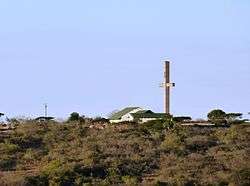 Dingaanstat Mission Station | |
 Dingaanstat mission  Dingaanstat mission Dingaanstat mission (South Africa)  Dingaanstat mission Dingaanstat mission (Africa) | |
| Coordinates: 28°26′06″S 31°16′44″E / 28.435°S 31.279°ECoordinates: 28°26′06″S 31°16′44″E / 28.435°S 31.279°E | |
| Country | South Africa |
| Province | KwaZulu-Natal |
| District | Zululand |
| Municipality | Ulundi |
| Time zone | UTC+2 (SAST) |
Dingaanstat is the 'stat' or village of Dingaan (Dingane, Udingane). The village is known to the Zulu as Umgungundlovu, and was under Zulu rule from 1795 until 1840. Now a mission station of the Dutch Reformed Church, it is situated between Melmoth and Babanango.[1]
References
- ↑ Raper, Peter E. (1987). Dictionary of Southern African Place Names. Internet Archive. p. 139. Retrieved 28 August 2013.
External links

Municipalities and communities of Zululand District Municipality, KwaZulu-Natal | ||
|---|---|---|
District seat: Ulundi | ||
| Ulundi | .svg.png) | |
| Nongoma | ||
| Abaqulusi | ||
| uPhongolo | ||
| EDumbe | ||
This article is issued from
Wikipedia.
The text is licensed under Creative Commons - Attribution - Sharealike.
Additional terms may apply for the media files.