Dinedor
| Dinedor | |
|---|---|
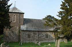 Dinedor Church | |
| Population | 328 (2011)[1] |
| OS grid reference | SO510363 |
| Civil parish |
|
| Shire county | |
| Region | |
| Country | England |
| Sovereign state | United Kingdom |
| Post town | Hereford |
| Postcode district | HR2 |
| Police | West Mercia |
| Fire | Hereford and Worcester |
| Ambulance | West Midlands |
| EU Parliament | West Midlands |
Dinedor is a hill, village and civil parish in Herefordshire, England.[2][3] Dinedor is situated 5 km (3.1 mi) south east of Hereford. The hilltop is the site of an Iron Age fort.
The name Dinedor is possibly of Celtic origin meaning hill with a fort.[4]
References
- ↑ "Civil Parish population 2011". Retrieved 29 October 2015.
- ↑ Ordnance Survey: Landranger map sheet 149 Hereford & Leominster (Bromyard & Ledbury) (Map). Ordnance Survey. 2009. ISBN 9780319229538.
- ↑ "Ordnance Survey: 1:50,000 Scale Gazetteer" (csv (download)). www.ordnancesurvey.co.uk. Ordnance Survey. 1 January 2016. Retrieved 18 February 2016.
- ↑ Mills, A.D. (2011) [first published 1991]. A Dictionary of British Place Names (First edition revised 2011 ed.). Oxford: Oxford University Press. p. 153. ISBN 9780199609086.
External links
![]()
Coordinates: 52°01′37″N 2°40′52″W / 52.027°N 2.681°W
This article is issued from
Wikipedia.
The text is licensed under Creative Commons - Attribution - Sharealike.
Additional terms may apply for the media files.