Dikwillem
| Dicker Wilhelm | |
|---|---|
|
Dikwillem | |
.jpg) Dicker Wilhelm with Wild Horses in front | |
| Highest point | |
| Elevation | 1,496 m (4,908 ft) |
| Coordinates | 26°28′04″S 016°01′08″E / 26.46778°S 16.01889°ECoordinates: 26°28′04″S 016°01′08″E / 26.46778°S 16.01889°E |
| Geography | |
 Dicker Wilhelm Position of Dicker Wilhelm | |
| Location | Namibia |

Aerial view of Dicker Wilhelm (2010)
Dikwillem (Afrikaans) or Dicker Wilhelm (German), also known as Garub-Berg[1] or Garubberg, is a very striking mountain in Namibia, well visible from a great distance and from all directions.[2] Dikwillem has an elevation of 1496 meters. The mountain lies within the Namib desert, about 15 kilometers north of the National Road B4 and about 80 kilometers east of Lüderitz.
The harsh environment and barren plains around Garub[3] became habitat of the desert horses of the Namib. They are said to be descendants from German cavalry horses and adapted to the conditions and dry climate of the desert.
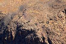
Ruins of German Schutztruppe on top of Dikwillem (Bird's eye view 2017)
During the time of German colonial empire a heliographic station was operated by the German Schutztruppe on top of Dikwillem.[4]
Pictures
Pictures of Dikwillem
![]()
References
- ↑ See German Getamap.net
- ↑ Namibia Travel Map. Kunth-Verlag, München 2017, ISBN 978-3-95504-578-4.
- ↑ See German Wikipedia: Garub
- ↑ See German Book Stefan Loose Reiseführer Namibia
This article is issued from
Wikipedia.
The text is licensed under Creative Commons - Attribution - Sharealike.
Additional terms may apply for the media files.