Diabugu
| Diabugu | |
|---|---|
| Nickname(s): Diabanna, Diafara, Diadolay | |
 Diabugu Location in the Gambia | |
| Coordinates: 13°23′N 14°24′W / 13.383°N 14.400°WCoordinates: 13°23′N 14°24′W / 13.383°N 14.400°W | |
| Country |
|
| Division | Upper River Division |
| District | Sandu |
| Government | |
| • Alikalo | Alhaji Kursa Drammeh |
| Population (2016) | |
| • Total | 9,000 (est.) |
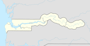
Diabugu is a village in eastern Gambia. It is located in Sandu District in the Upper River Division.It is the biggest village in Sandu. It was founded by Foday Sillah about 350 years ago. Foday Sillah's grandson Foday Sillah junior established the village of Jagejari as a farming centre. As time goes on some of his children settled there permanently.
Foday Sillah Junior's son Ba Sillah was the last Alkalo village head of Diabugu among the Sillah Kunda dynasty. Ba Sillah went to established a new settlement called Diabugu Ba Sillah South of the River Gambia. He then left the village to his first cousinand brother-in-law Mahamadou Mankoro Drammeh Sama. The Drammeh Sama of Diabugu has since inherited the leadership of Diabugu Batapa. Under the leadership of Mankoro's eldest son Madala Drammeh Sama, the Drammeh Kanji and Drammeh Sama were united. Inheritance of the Alkaloship is now based on seniority.
The first Drammeh Kanji to become Alkalo of Diabugu was Batapa Drammeh. Batapa Drammeh was a brave giant of Drammeh Kunda and because of this bravery, Diabugu has his name. This is why it is called Diabugu Batapa.
As of 2016, it has an estimated population of 9000.[1]
References
- ↑ "Gambia: largest cities and towns and statistics of their population". World Gazetteer. Archived from the original on May 22, 2011. Retrieved January 3, 2009.