Dharamkot, Himachal Pradesh
| Dharamkot | |
|---|---|
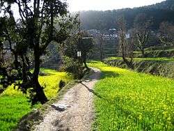 A mustard field at Dharamkot near Dharamshala | |
 Dharamkot Location in Himachal Pradesh, India | |
| Coordinates: 32°14′19″N 76°19′26″E / 32.238602°N 76.323878°ECoordinates: 32°14′19″N 76°19′26″E / 32.238602°N 76.323878°E | |
| Country |
|
| State | Himachal Pradesh |
| District | Kangra |
| Elevation | 2,100 m (6,900 ft) |
| Languages | |
| Time zone | UTC+5:30 (IST) |
Dharamkot is a small hill station in Kangra district in the state of Himachal Pradesh, India.
On the crest of a hill above McLeodGanj, Dharamkot is a spot with wide views of the Kangra Valley and the Dhauladhar ranges. There are a couple of small eateries around. Several foreigners have taken residence in the area; all live in village homes and guest houses. Dharamkot also has the Vipassana meditation centre, Dhamma Shikara, as well as the Tushita Meditation Centre which is a centre for the study and practice of Buddhism in the Tibetan Mahayana tradition.
Past Dharamkot, at a distance of 9 km from McLeodGanj, much of which is a steady climb, Triund is at the foot of the Dhauladhar ranges and is at a height of 2,827 m. The snow line, which is considered to be the most easily accessible in the entire Himalayan range starts from Ilaqua, 4 km from Triund. A good walker will take around four hours to reach Triund from McLeodganj and another one and a half to two hours to reach Ilaqua. After Dharamkot, one passes by the Galu Devi Temple when the climb and the trail becomes demanding.
Triund
The trek to Triund starts from Gallu Devi temple, where people going for this trek are first asked to register their names. From Mcleodganj, a person first must reach Dharamkot via auto or you can simply get a cab straight to Gallu Devi temple.
The trek mostly is a straight route up to Triund. The distance is 11 kilometers and usually takes about 4–5 hours.
The reason it's called Triund is because of the 3 mountains that a person can see from that point. These 3 snow-covered mountains are usually snow capped throughout the year, so Tri means three and Und means mountains. There is no provision for electricity and toilets up there and the mobile signals are hard to find.
Snowline
The next stop after Triund is Snowline. It is a 2-3 hour trek from Triund and usually is a stop for those wanting to go further up to Indrahar Pass. Snowline also presents views and the altitude is also higher than Triund. There is only one cafe up there. The snowline cafe as it is called, also has provisions for sleeping bags and tents.
Gallery
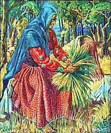 Gaddi woman cutting grass, Dharamkot. By Alfred Hallett c. 1980.
 View from Dharamkot looking west. 1980
 Carlton Cottage. Dharamkot. 1980
 Majestic view from Magic Cafe; one of the 4 cafes on the way to Triund.
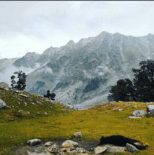 View from just outside Snowline Cafe. November 2015