Denair, California
| Denair | |
|---|---|
| Census-designated place | |
| Motto(s): The Oasis of the San Joaquin Valley | |
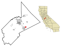 Location in Stanislaus County and the state of California | |
| Coordinates: 37°31′39″N 120°47′59″W / 37.52750°N 120.79972°WCoordinates: 37°31′39″N 120°47′59″W / 37.52750°N 120.79972°W | |
| Country |
|
| State |
|
| County | Stanislaus |
| Area[1] | |
| • Total | 1.981 sq mi (5.131 km2) |
| • Land | 1.981 sq mi (5.131 km2) |
| • Water | 0 sq mi (0 km2) 0% |
| Elevation | 125 ft (38 m) |
| Population (2010) | |
| • Total | 4,404 |
| • Density | 2,200/sq mi (860/km2) |
| Time zone | UTC-8 (Pacific) |
| • Summer (DST) | UTC-7 (PDT) |
| ZIP code | 95316 |
| Area code | 209 |
| FIPS code | 06-18856 |
| GNIS feature ID | 1655964 |
Denair is a census-designated place (CDP) in Stanislaus County, California, United States. The population was 4,404 at the 2010 census, up from 3,446 at the 2000 census. It is part of the Modesto Metropolitan Statistical Area.
History
Denair was established in 1904, along the Santa Fe Railroad tracks. The town was renamed from Elmwood Colony to Denair in honor of a local landowner, John Denair. One famous person known to have grown up in Denair is artist and musician Doug TenNapel.
Geography
Denair is located at 37°31′39″N 120°47′59″W / 37.52750°N 120.79972°W (37.527532, -120.799813).[2]
According to the United States Census Bureau, the CDP has a total area of 2.0 square miles (5.2 km2), all of it land.
Demographics
| Historical population | |||
|---|---|---|---|
| Census | Pop. | %± | |
| U.S. Decennial Census[3] | |||
2010
The 2010 United States Census[4] reported that Denair had a population of 4,404. The population density was 2,222.9 people per square mile (858.2/km²). The racial makeup of Denair was 3,425 (77.8%) White, 25 (0.6%) African American, 55 (1.2%) Native American, 42 (1.0%) Asian, 4 (0.1%) Pacific Islander, 699 (15.9%) from other races, and 154 (3.5%) from two or more races. Hispanic or Latino of any race were 1,423 persons (32.3%).
The Census reported that 4,404 people (100% of the population) lived in households, 0 (0%) lived in non-institutionalized group quarters, and 0 (0%) were institutionalized.
There were 1,451 households, out of which 611 (42.1%) had children under the age of 18 living in them, 913 (62.9%) were opposite-sex married couples living together, 168 (11.6%) had a female householder with no husband present, 86 (5.9%) had a male householder with no wife present. There were 71 (4.9%) unmarried opposite-sex partnerships, and 10 (0.7%) same-sex married couples or partnerships. 221 households (15.2%) were made up of individuals and 113 (7.8%) had someone living alone who was 65 years of age or older. The average household size was 3.04. There were 1,167 families (80.4% of all households); the average family size was 3.38.
The population was spread out with 1,233 people (28.0%) under the age of 18, 407 people (9.2%) aged 18 to 24, 1,186 people (26.9%) aged 25 to 44, 1,098 people (24.9%) aged 45 to 64, and 480 people (10.9%) who were 65 years of age or older. The median age was 34.8 years. For every 100 females, there were 96.8 males. For every 100 females age 18 and over, there were 94.3 males.
There were 1,523 housing units at an average density of 768.7 per square mile (296.8/km²), of which 1,128 (77.7%) were owner-occupied, and 323 (22.3%) were occupied by renters. The homeowner vacancy rate was 2.1%; the rental vacancy rate was 5.2%. 3,275 people (74.4% of the population) lived in owner-occupied housing units and 1,129 people (25.6%) lived in rental housing units.
2000
As of the census[5] of 2000, there are 3,446 people, 1,131 households, and 907 families residing in the CDP. The population density is 1,697.3 people per square mile (655.4/km²). There are 1,162 housing units at an average density of 572.3 per square mile (221.0/km²). The racial makeup of the CDP is 78.61% White, 0.26% African American, 1.45% Native American, 0.23% Asian, 0.03% Pacific Islander, 15.35% from other races, and 4.06% from two or more races. 26.55% of the population are Hispanic or Latino of any race.
There are 1,131 households out of which 42.2% have children under the age of 18 living with them, 63.4% are married couples living together, 11.9% have a female householder with no husband present, and 19.8% are non-families. 15.4% of all households are made up of individuals and 6.6% have someone living alone who is 65 years of age or older. The average household size is 3.05 and the average family size is 3.41.
In the CDP, the population is spread out with 29.7% under the age of 18, 9.3% from 18 to 24, 27.2% from 25 to 44, 24.1% from 45 to 64, and 9.7% who are 65 years of age or older. The median age is 34 years. For every 100 females, there are 97.0 males. For every 100 females age 18 and over, there are 97.0 males.
The median income for a household in the CDP is $41,399, and the median income for a family is $46,538. Males have a median income of $38,598 versus $28,929 for females. The per capita income for the CDP is $15,278. 16.1% of the population and 11.1% of families are below the poverty line. Out of the total population, 25.3% of those under the age of 18 and 3.0% of those 65 and older are living below the poverty line.
Controversy
On November 8, 2010 Denair Middle School asked a student to remove the American flag from the back of his bicycle citing Mexicans and fears for the students safety. Four days later, Denair School Superintendent, Edward Parraz overturned the decision again allowing the student to display the flag adding that the racial concerns would be discussed with the students involved and their parents.[6][6][7][8][9][10][11]
Government
In the California State Legislature, Denair is in the 8th Senate District, represented by Republican Tom Berryhill, and in the 12th Assembly District, represented by Republican Heath Flora.[12]
In the United States House of Representatives, Denair is in California's 10th congressional district, represented by Republican Jeff Denham.[13]
References
- ↑ "2010 Census U.S. Gazetteer Files – Places – California". United States Census Bureau.
- ↑ "US Gazetteer files: 2010, 2000, and 1990". United States Census Bureau. 2011-02-12. Retrieved 2011-04-23.
- ↑ "Census of Population and Housing". Census.gov. Retrieved June 4, 2016.
- ↑ "2010 Census Interactive Population Search: CA - Denair CDP". U.S. Census Bureau. Retrieved July 12, 2014.
- ↑ "American FactFinder". United States Census Bureau. Archived from the original on 2013-09-11. Retrieved 2008-01-31.
- 1 2 http://www.fox40.com/news/headlines/ktxl-americanflagbike11122010,0,3045879.htmlstory Archived August 20, 2012, at the Wayback Machine.
- ↑ "School Reverses Course After Ordering Student to Remove American Flag From Bike - American Flag - Fox Nation". Fox News. 12 November 2010.
- ↑ "School Forces Boy To Take Flag Off Bike | KCRA Home - KCRA Home". Kcra.com. 2010-11-11. Retrieved 2013-04-29.
- ↑ Archived March 4, 2012, at the Wayback Machine.
- ↑ "Flag Removed: Interview with school Superintendent". Fox40. 12 November 2010. Archived from the original on 2012-03-04.
- ↑ YouTube from KCRA: Bikers Escort Denair Boy to School
- ↑ "Statewide Database". UC Regents. Retrieved January 30, 2015.
- ↑ "California's 10th Congressional District - Representatives & District Map". Civic Impulse, LLC. Retrieved September 28, 2014.
Municipalities and communities of Stanislaus County, California, United States | ||
|---|---|---|
| Cities | 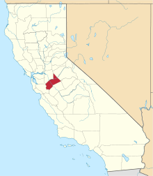 | |
| CDPs | ||
| Unincorporated communities | ||
| Ghost towns | ||