Deliceto
| Deliceto | |
|---|---|
| Comune | |
| Comune di Deliceto | |
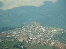 View of Deliceto | |
 Deliceto Location of Deliceto in Italy | |
| Coordinates: 41°13′N 15°23′E / 41.217°N 15.383°ECoordinates: 41°13′N 15°23′E / 41.217°N 15.383°E | |
| Country | Italy |
| Region |
|
| Province | Foggia (FG) |
| Government | |
| • Mayor | Antonio Montanino |
| Area | |
| • Total | 75.65 km2 (29.21 sq mi) |
| Elevation | 575 m (1,886 ft) |
| Population (28 February 2017)[1] | |
| • Total | 3,769 |
| • Density | 50/km2 (130/sq mi) |
| Demonym(s) | Delicetani |
| Time zone | UTC+1 (CET) |
| • Summer (DST) | UTC+2 (CEST) |
| Postal code | 71026 |
| Dialing code | 0881 |
| Patron saint | St. Benvenuto, Maria S.S. dell'Olmitello |
| Saint day | 22 September |
| Website | Official website |
Deliceto (Delicetano: Delecìte) is a small town and comune in the province of Foggia, from which it is 40.3 kilometres (25.0 mi), in the Apulia region of southeast Italy. Adjacent towns are Ascoli Satriano (to the east); Bovino, Castelluccio dei Sauri (to the north and the north-west); Sant'Agata di Puglia (to the south); Candela (to the south-east); Accadia (to the south-west).
Deliceto rises on the peak of a hill, surrounded by woods and streams. The territory of the municipality lies between 207 and 951 metres (679 and 3,120 ft) above sea level.
References
This article is issued from
Wikipedia.
The text is licensed under Creative Commons - Attribution - Sharealike.
Additional terms may apply for the media files.