Dege Peak
| Dege Peak | |
|---|---|
 Dege Peak seen from the east at Sunrise Point.jpg | |
| Highest point | |
| Elevation | 7,006 ft (2,135 m) [1] |
| Prominence | 286 ft (87 m) [1] |
| Coordinates | 46°55′07″N 121°36′39″W / 46.918529°N 121.610713°WCoordinates: 46°55′07″N 121°36′39″W / 46.918529°N 121.610713°W |
| Geography | |
 Dege Peak Location of Dege Peak in Washington  Dege Peak Dege Peak (the US) | |
| Location | Mount Rainier National Park, Pierce County, Washington, U.S. |
| Parent range | Cascades |
| Topo map | USGS White River Park |
| Climbing | |
| Easiest route | Trail |
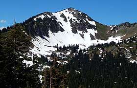
Dege Peak[2] is a 7,006 feet (2,135 m) summit located in Pierce County of Washington state. It is part of the Sourdough Mountains in Mount Rainier National Park. It was named in 1932 for James Henry Dege (born 1868), a prominent Tacoma businessman and Captain of the First Regiment National Guard of Washington.[3] His mother was a descendant of President Zachary Taylor.
The peak is a popular hiking destination with views of the Emmons Glacier, Winthrop Glacier, Inter Glacier, Fryingpan Glacier, Little Tahoma Peak, and views in all directions because the trail is above tree line. The trail starts at the Sunrise Historic District. Access is limited by snow closing the Sunrise Road much of the year. July, August, and September are the months when the Sunrise Road is seasonally open for vehicle traffic.
Antler Peak is its nearest higher peak, 1.03 mi (1.66 km) to the west.[1] Precipitation runoff from Dege Peak drains into the White River.
Flora
 Lomatium martindalei'
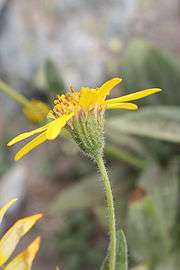 Arnica mollis
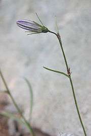 Campanula rotundifolia
 Abies lasiocarpa
Climate
Dege Peak is located in the marine west coast climate zone of western North America.[4] Most weather fronts originate in the Pacific Ocean, and travel northeast toward the Cascade Mountains. As fronts approach, they are forced upward by the peaks of the Cascade Range (Orographic lift), causing them to drop their moisture in the form of rain or snowfall onto the Cascades. As a result, the west side of the Cascades experiences high precipitation, especially during the winter months in the form of snowfall. During winter months, weather is usually cloudy, but, due to high pressure systems over the Pacific Ocean that intensify during summer months, there is often little or no cloud cover during the summer. Because of maritime influence, snow tends to be wet and heavy, resulting in high avalanche danger.
Gallery
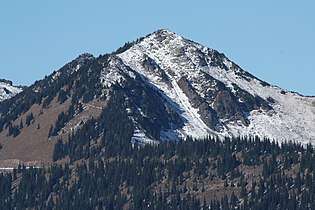 Dege Peak
 Dege Peak seen from Sunrise area
 Dege Peak seen from Sunrise Point
References
- 1 2 3 "Dege Peak, Washington". Peakbagger.com.
- ↑ "Dege Peak". Geographic Names Information System. United States Geological Survey. Retrieved 2018-08-07.
- ↑ Notable Men of Washington. Perkins Press, 1912.
- ↑ Beckey, Fred W. Cascade Alpine Guide, Climbing and High Routes. Seattle, WA: Mountaineers Books, 2008.
External links
- National Park Service web site: Mount Rainier National Park