Deep Creek Valley
| Deep Creek Valley | |
| Valley | |
 View southeasterly across valley, west flank Deep Creek Mountains | |
| Country | United States |
|---|---|
| State | Utah |
| Regions | (northeast)-Great Basin (southwest)-Great Salt Lake Desert |
| Counties | Tooele, Juab |
| Borders on | Great Salt Lake Desert-NNE Gold Hill, Utah-(Gold Hill)-NE Deep Creek Mountains-E, S, & SW Antelope Valley-W Ferber Hills-NW |
| Communities | Ibapah, Goshute, Salt Springs, (Gold Hill, Utah) |
| Creeks | Deep Creek & East Deep Creek |
| Coordinates | 40°10′37″N 113°59′49″W / 40.1769°N 113.9969°WCoordinates: 40°10′37″N 113°59′49″W / 40.1769°N 113.9969°W |
| Length | 35 mi (56 km), N-S |
| Width | 4 mi (6 km), (varies, 7-9-mi, at northeast with Great Salt Lake Desert, northwest of Gold Hill) |
 Deep Creek Valley-(at White Sage Flat) in Utah | |
| Wikimedia Commons has media related to Ibapah, Utah. |
| Wikimedia Commons has media related to Deep Creek Range. |
Deep Creek Valley is a 35-mi (56 km) long[1] valley located in southwest Tooele County at the Utah-Nevada border; the extreme south of the valley is in northwest Juab County. The valley parallels the west flank of the Deep Creek Range, both north-trending. In the north-northeast, its outlet widens into the southwest of the Great Salt Lake Desert region.
The mountain range turns southwest and west in the south, and encloses the higher altitude terrain of the valley; here, the Goshute Indian Reservation lies in the mountains and the Deep Creek Valley's south; the community of Goshute is adjacent the valley; the reservation also extends westward into Nevada, into the east of the Antelope Valley.
Description
Deep Creek Valley follows the drainage of the north-flowing Deep Creek. In the valley's southern half, from Ibapah, UT on Deep Creek, at the northwest of the Deep Creek Range, and south, (East Deep Creek), to Goshute in the mountains, nine canyons and washes feed the Deep Creek system from the Deep Creek Range. Hills west, about 7-9 mi[2] of drainage, from Antelope Valley's east perimeter, washes flow east or northeast.
The Deep Creek Valley is narrow, only about 4 mi, but follows circuitous routes around small hills, as well as Gold Hill northeast, and the Ferber Hills, northwest on the Nevada-Utah border. On Deep Creek, at the south of these two hill regions, and with the northwest convergence of the Deep Creek Range, is White Sage Flat. Washes/ creeks converge here at the Flat, but Deep Creek continues on north-flowing.
The center of the valley is between White Sage Flat, and Ibapah, 40°02′12″N 113°59′07″W / 40.03667°N 113.98528°W to the south.
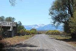 View in Ibapah, UT
References
External links
- White Sage Flat, hometownlocator, coordinates(Map close-up of Deep Creek, west of Gold Hill Pass, Gold Hill, Utah)