De Knipe
| De Knipe | ||
|---|---|---|
| Village | ||
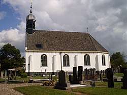 De Knipe church | ||
| ||
 Location in the Heerenveen municipality | ||
 De Knipe Location in the Netherlands | ||
| Coordinates: Coordinates: 52°58′7″N 5°58′16″E / 52.96861°N 5.97111°E | ||
| Country |
| |
| Province |
| |
| Municipality |
| |
| Population (2017) | ||
| • Total | 1,455 | |
| Time zone | UTC+1 (CET) | |
| • Summer (DST) | UTC+2 (CEST) | |
| Postal code | 8456 | |
| Telephone area | 0513 | |

De Knipe is a village in the municipality (Dutch: Gemeente) Heerenveen in the province of Friesland, the Netherlands. It had a population of around 1,455 in January 2017.[1]
Note: Dutch: De Knijpe was a unofficial translation that has never been accepted by the City Hall of Heerenveen, and should therefore by avoided.
References
- ↑ Kerncijfers wijken en buurten 2017 - CBS Statline
External links
![]()
This article is issued from
Wikipedia.
The text is licensed under Creative Commons - Attribution - Sharealike.
Additional terms may apply for the media files.