Dawesley
| Dawesley South Australia | |||||||||||||||
|---|---|---|---|---|---|---|---|---|---|---|---|---|---|---|---|
 | |||||||||||||||
 Dawesley | |||||||||||||||
| Coordinates | 35°02′29″S 138°56′29″E / 35.0415°S 138.9414°ECoordinates: 35°02′29″S 138°56′29″E / 35.0415°S 138.9414°E | ||||||||||||||
| Established | 1857 | ||||||||||||||
| Location | |||||||||||||||
| LGA(s) | District Council of Mount Barker | ||||||||||||||
| State electorate(s) | electoral district of Kavel | ||||||||||||||
| Federal Division(s) | Division of Mayo | ||||||||||||||
| |||||||||||||||
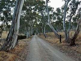
Dawesley is a settlement in South Australia.[1] It is in the Adelaide Hills 40 km southeast of Adelaide. It is on Dawesley Creek, a tributary of the Bremer River, and the old Princes Highway between Nairne and Kanmantoo. It is in the Hundred of Kanmantoo.[2]
Mount Beevor station, once held by T. Hope Murray, is nearby.[3]
History
The town was laid out by William Bower Dawes and sold at the District Hotel, Nairne, on 4 May 1857.[4]
References
- ↑ "2905.0 - Statistical Geography: Volume 2 -- Census Geographic Areas, Australia, 2006". Australian Bureau of Statistics. Retrieved 8 December 2009.
- ↑ South Australian Names
- ↑ "Family Notices". The Advertiser. Adelaide. 2 May 1903. p. 6. Retrieved 15 November 2014 – via National Library of Australia.
- ↑ Manning, Geoffrey. "Dawesley" (PDF). Manning Index of South Australian History - Place Names. Retrieved 6 November 2017 – via State Library of South Australia.
This article is issued from
Wikipedia.
The text is licensed under Creative Commons - Attribution - Sharealike.
Additional terms may apply for the media files.