Data Kakus
| Data Kakus | |
|---|---|
 Data Kakus | |
| Coordinates: 2°42′00″N 113°33′00″E / 2.70000°N 113.55000°E | |
| Country |
|
| State |
|
| Administrative Division | Tatau |
| Elevation | 210 m (690 ft) |
| Population (2017) | |
| • Total | 3,500 |
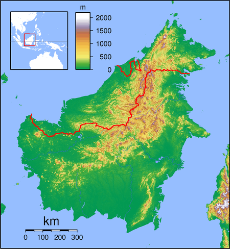
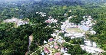
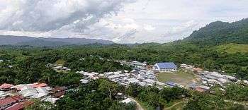
Data Kakus (a.k.a. Apau Data) is a remote Kenyah Badeng village settlement in the hilly interior of the Ulu Kakus Tatau division of Sarawak, Malaysia elevates to 650 metres, not far from Tubau and Belaga district. To be exact, Data Kakus is located at the upstream of Sungai Burok and Sungai Nyabet. The highest peak in Ulu Kakus is called Gunung Lumut about 828m located on the peak of Lumut Range not too far from Sungai Bekuyat and Sungai Kakus.
Travel to Data Kakus involves a five hours 4WD drive from Bintulu or Belaga, to get to Data Kakus you have to take the Bintulu-Bakun road and look for the junction to KTS camp from KTS camp to Simpang Jonat it takes about 60 km using the logging road and from simpang Jonat it takes another 18 km to reach Data Kakus.[1] or it is possible to trek Data Kakus from Belaga and it takes five to seven hours trekking from Long Sungai Pelaran (Sg. Sanan baan Kenyah), Sungai Ngajah from Rajang river then conquer Gunung Ngajah about 444m.[2] The Kakus River or Batang Tatau begins as a stream near Data Kakus called Alo Nyabet or e-iut Nyabet or Sungai Burok, and it flows through Data Kakus, the end point where small boats such as 'moto setinding' can navigate. It is also possible to travel downriver from Data Kakus by longboat to Tatau town,it takes almost a day to get to Tatau town by boat as the river is too shallow, winding and small.
Neighbouring settlements include:
- Rumah Ado 16.6 kilometres (10.3 mi) northwest
- Sungai Tinggili 15.6 kilometres (9.7 mi) northwest
- Long Beyak 8.6 kilometres (5.3 mi) southwest
- Sungai Kalavang 8.6 kilometres (5.3 mi) southwest
- Long Basurou 4.3 kilometres (2.7 mi) northwest
- Sungai Kakus 6.3 kilometres (3.9 mi) northwest
- Nyulau 5.6 kilometres (3.5 mi) north
- Kampung Kenyah Badeng Senep 50.2 kilometres (31.2 mi) north
Rice production
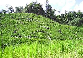
This is the main activity for most of the Kenyah people in Data Kakus, where most of the communities grow the paddy hill at a few fertile land such as Sungai Padai, Lalut Deram, Ulu Sungai Burok, Long Ledong, Long Basuruo, Usun Uma', Iut Nyabet, Sungai Kakus, Abak Uma', Diam Songan and Nyulau. The traditional paddy planting is started in early August and a few months before that we are clearing the land by burning the whole paddy field area.[3] Planting paddy hill takes place each year in August and September (nugan), and harvesting starts in February the following year.[4]
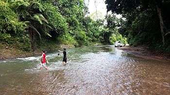
Photos of Data Kakus
References
- ↑ unknown (2 Feb 2010). "data kakus — kemudahan asas". Berita harian. Archived from the original on 20 December 2012. Retrieved 2010-02-14.
- ↑ Chee-Beng, Vom Roy ; edited with an introduction by Tan (1993). The migration of Kenyah Badeng : a study based on oral history. Kuala Lumpur: Institute of Advanced Studies, Universiti Malaya. p. 65. ISBN 9839576186.
- ↑ Garay-Barayazarra & Rajindra K Puri, Gotzone. "Smelling the monsoon" (PDF). senses and traditional weather forecasting. Retrieved 11 January 2011.
- ↑ Rita, Armstrong (1993). International bibliography of social and cultural anthropology 1992. London: Routledge. ISBN 0415092116.
External links
Coordinates: 2°42′00″N 113°33′00″E / 2.70000°N 113.55000°E