Dharwad
| Dharwad | |
|---|---|
| City | |
| Nickname(s): Pedha Nagari, Hubballi-Dharwad City, Dharanagari, Vidya Kashi. | |
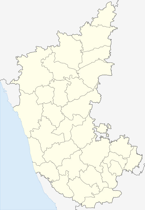
 Dharwad Location in Karnataka | |
| Coordinates: 15°27′30″N 75°00′30″E / 15.45833°N 75.00833°ECoordinates: 15°27′30″N 75°00′30″E / 15.45833°N 75.00833°E | |
| Country |
|
| State | Karnataka |
| District | Dharwad |
| Named for | Education Hub, Major Industries |
| Area | |
| • Total | 200.23 km2 (77.31 sq mi) |
| Elevation | 750.75 m (2,463.09 ft) |
| Languages | |
| • Official | Kannada |
| Time zone | UTC+5:30 (IST) |
| Vehicle registration | KA-25, KA-63 |
| Website |
www |
Dharwad is the district headquarters of Dharwad district in the state of Karnataka, India. It was merged with the city of Hubballi in 1961 to form the twin cities of Hubballi-Dharwad. It covers an area of 200.23 km² and is located 425 km northwest of Bengaluru, on NH-48, between Bengaluru and Pune.
History


The word "Dharwad" means a place of rest in a long travel or a small habitation. For centuries, Dharwad acted as a gateway between the Malenadu (western mountains) and the Bayalu seeme (plains); it became a resting place for travelers. The name is derived from the Sanskrit word 'dwarawata': 'dwara' meaning "door" and 'wata' or 'wada' meaning "town".
A different theory suggests that during the Vijayanagara rule of Dharwad there was a ruler by name "of Dharav" (1403), and Dharwad got its name from him. There are inscriptions that refer to Dharwad as Kampana Sthana.
Inscriptions found near Durga Devi temple in Narendra (a nearby village) and RLS High School date back to the 12th century and have references to Dharwad. This makes Dharwad at least 900 years old. Also, there is an inscription at Hanuman Temple at Bankapur lake near Garag (a village about 18 km from Dharwad).
The Chalukyas ruled Dharwad during the 12th century. A stone inscription indicates that there was a ruler by the name of BhaskaraDeva in 1117. In the 14th century, the district was first overrun by the Bahmani Sultanate, after which it was annexed to the newly established Hindu kingdom of Vijayanagar, an official of which named Dhar Rao, according to local tradition, built the fort at Dharwad town in 1403. After the defeat of the king of Vijayanagar at Talikot (1565), Dharwad was for a few years practically independent under its Hindu governor; but in 1573 the fort was captured by the sultan of Bijapur, Adil Shah, and Dharwad was annexed to his dominions. Adil Shah built a fort in an area later called Manna Killa, and later Nazratabad. With this fort, the strategic importance of Dharwad increased and it attracted the attention of subsequent conquerors, including Aurangzeb, Shivaji, Aurangzeb's son Muhammad Muazzam known as Bahadur Shah I or Shah Alam, the seventh Mughal emperor (1707-1712), Peshwa Balaji Baji Rao, Hyder Ali, Tipu Sultan and finally the British colonizers.
In 1685, the fort was taken by the Mughal emperor Aurangzeb, and Dharwad, on the break-up of the Mughal empire, fell under the sway of the Maratha Peshwa of Pune. In 1764, the province was overrun by Hyder Ali of the Mysore, who in 1778 captured the fort of Dharwad.[1] The fort was retaken in 1791 by the Marathas. After the final defeat of the Peshwa by the British in 1818, Dharwar was incorporated into the territory of the British East India Company's Bombay Presidency. During the early 19th century, when the British were expanding their domains, they faced a lot of opposition from local rulers, including Baba Saheb of Naragund and Kittur Chennamma. Dharwad was independent before 1947.
Demographics
The population of the twin cities as per provisional figures of Census 2011 is 1,349,563 and is urban.[2] Hubli-Dharwad's population increased 22.99% between 1981 and 1991, from 527,108 to 648,298, and by 21.2% between 1991 and 2001. The municipality covers 191 km². Hubballi-Dharwad is located 425 km northwest of Bengaluru, on the National Highway 4, just half-way between Bengaluru and Pune. The City is governed by the Hubli-Dharwad Municipal Corporation, having an elected council. Kannada is the major language spoken in Dharwad District. Dharwad is the city where the first fight for unification of Karnataka - Karnataka Ekikarana - was staged. Hence, it holds a special place in the hearts of the people of Karnataka, especially North Karnataka. Unification of Karnataka
Geography
Dharwad is situated on the edge of Western Ghats and hence is a hilly town. Spread over seven small hills at an average altitude of 750 meters above sea level, the city enjoys a salubrious climate amidst thick vegetation. Years ago, Dharwad was known for its lakes but several have now dried out. The lakes that still exist are Sadhankeri, Kelgeri (a man made lake created during British rule, almost 100 years old), Navalur, Hosayallapur and Nuggikeri. The city still has a few more small lakes left, in spite of rapid urbanization. Dharwad sits at the cusp of two distinct geographical divisions – Malenadu (hilly, forest land with red soil) and Belavalanaadu (Deccan plains with black soil).
Dharwad has plenty of green cover. Karnatak University's Botanical Garden is a sanctuary for many rare plants, trees and birds. Kelgeri, Sadhanakeri, Navalur and Nuggikeri are also homes for water birds.
Climate
The climate is mildly hot during the summer (April–May), and pleasant during rest of the year, as it is at an altitude of about 750 m, plus still has a lot of greenery round. Dharwad is well known as a quiet and pleasant city popular with students and pensioners. The average yearly rainfall is 838mm
Dharwad is known as Chhota Mahabaleshwar due to its excellent climate throughout the year. Summers are mildly hot with occasional thunderstorms, lasting from late February to early June. They are followed by the monsoon season, with moderate temperatures and a large amount of precipitation. Temperatures are fairly moderate from late October to early February, with virtually no rainfall.
| Climate data for Dharwad | |||||||||||||
|---|---|---|---|---|---|---|---|---|---|---|---|---|---|
| Month | Jan | Feb | Mar | Apr | May | Jun | Jul | Aug | Sep | Oct | Nov | Dec | Year |
| Average high °C (°F) | 29 (84) |
32 (90) |
34 (93) |
35 (95) |
34 (93) |
28 (82) |
26 (79) |
26 (79) |
28 (82) |
29 (84) |
29 (84) |
28 (82) |
30 (86) |
| Average low °C (°F) | 15 (59) |
16 (61) |
19 (66) |
21 (70) |
21 (70) |
21 (70) |
21 (70) |
20 (68) |
20 (68) |
19 (66) |
17 (63) |
15.8 (60.4) |
19.4 (66.9) |
| Average precipitation mm (inches) | 0 (0) |
0 (0) |
10 (0.39) |
40 (1.57) |
60 (2.36) |
150 (5.91) |
210 (8.27) |
200 (7.87) |
110 (4.33) |
60 (2.36) |
30 (1.18) |
0 (0) |
838 (32.99) |
Civic administration
Hubli-Dharwad Municipal Corporation (HDMC) was constituted in 1962 by combining two cities separated by a distance of 20 kilometers.[3] The area covered by the corporation is 181.66 km². spread over 45 revenue villages. The population of the city as per the 1991 census was 7 lakhs. The present population is more than 10 lakhs.
- Hubballi: Under the Government of India Act of 1850, the Hubballi-Municipal council was established on 15 August 1855.
- Dharwad: The Dharwad Municipal Council first came into existence on 1 January 1856. The first non-official President of the Council was S.K. Rodda in 1907, and Shri S.V. Mensinkai, was nominated in the following year. But the credit of being the first elected President goes to Shri S.G. Karigudari, who took office in 1920.
Hubballi is well known as a commercial as well as industrial centre, whereas Dharwad is seat of learning.[4] Popularly believed that, it is this diversity and geographical positions that the state government amalgamated the two cities.[5] The twin-city corporation occupies unique place in Karnataka State. After the capital city of Bangalore, this is the largest city Corporation in the State.[5]
Economy
Agriculture
Dharwad cultivates a variety of crops. The Dharwad Cotton Hybrid (DCH), a popular product until a few years back, was invented in the University of Agricultural Sciences, Dharwad. In addition to this, Dharwad produces varieties of channa, kardi, soya and groundnut seeds. Farmers grow sugarcane, paddy, jowar, wheat, green gram, Bengal gram, moong and many other crops. Dharwad Alphonso mangoes and Navalur guavas are famous.
Industrial and business development

One of the largest automotive manufacturers, Tata Motors, has a commercial vehicle manufacturing facility at Dharwad. The unit produces small and intermediate commercial vehicles for the Indian market. The plant is on NH4, 11 km from Dharwad near Belur industrial estate, next to the high court bench of Karnataka, Dharwad.
Hubballi-Dharwad is a developing industrial hub in Karnataka after Bangalore, with more than 1000 allied small and medium industries established in Gokul Road[6] and Tarihal[7] regions of Hubli. There are machine tools industries, electrical, steel furniture, food products, rubber and leather industries, and tanning industries.
To promote the overall economic development of industries, institutions and businesses, the Karnataka Chamber of Commerce & Industry[8] was formed. It is one of the premier associations, which has been gaining momentum in achieving potential growth and prosperity in Hubli region.[9] One key aspect of industrialisation for Hubballi-Dharwad was foundation of Agricultural Produce Market Committee, which aimed at providing hassle-free market conditions for farmers, to establish regulated and stimulated production of agricultural related commodities and goods.[10][11]
The new generation diesel locomotive shed in the city by Indian railways[12] was another major boost for development of industries in this region. It was the first of its kind in Indian Railways history and created job opportunities for diploma and engineering students of this region.
Hubballi Software IT Park is in the heart of the city and is promoted by the Government of Karnataka IT Department and KEONICS acts as the modal agency for maintaining and marketing of IT Park Hubballi. STPI-Hubballi Software Technology Parks of India (organization under the Dept of IT, Government of India) has been operational from May 2001. It is on the 4th Floor of IT Park, to provide data communication, industry promotion and incubation services to IT/ITES industry.
Wallace Laboratories Pvt. Ltd. has established its manufacturing unit at Dharwad.[13]
See also
References
- ↑ "Imperial Gazetteer2 of India, Volume 11, page 316 – Imperial Gazetteer of India – Digital South Asia Library". Dsal.uchicago.edu. Retrieved 2009-11-15.
- ↑ "Census of India 2011 Provisional Population Totals" (PDF).
- ↑ "Home - ಹುಬ್ಬಳ್ಳಿ-ಧಾರವಾಡ ಮಹಾನಗರ ಪಾಲಿಕೆ (Hubballi-Dharwad Municipal Corporation)".
- ↑ "about hubli – dharwad" (PDF). Archived from the original (PDF) on 2013-06-13.
- 1 2 "HDMC ABOUT TWIN CITY". Archived from the original on 2012-04-20.
- ↑ "Gokul Road (Hubballi (Hubali))".
- ↑ "Tarihal – Google Maps".
- ↑ "Main building".
- ↑ "Karnatak Chamber of Commerce and Industry".
- ↑ "Agmarknet Mandi profile".
- ↑ "APMC (Hubballi (Hubali))".
- ↑ "Welcome to SOUTHWESTERN RAILWAY".
- ↑ "Wallace Laboratories, Dharwad, Karnataka". Wallace Pharma. Retrieved 5 July 2017.
External links
| Wikimedia Commons has media related to Dharwad. |
