Danube Bend
The Danube Bend (Hungarian Dunakanyar) is a curve of the Danube in Hungary, close to the city of Visegrád.

Geology
The bend had long been a puzzle to geologists.The present-day U-shaped loop is now known to have been caused by eruption of a volcano 15 million years ago. The caldera of Keserűs Hill volcano, with an associated lava dome forms an eroded central depression to the north. The river follows the southern edge of this caldera. [1]
References
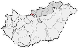
Danube Bend (in red) as one of microregions in physical geography of Hungary
- ↑ Karátson, Dávid (2015). Landscapes and Landforms of Hungary. Springer, Cham. pp. 129–137. doi:10.1007/978-3-319-08997-3_16.
See also
Coordinates: 47°47′57″N 19°05′30″E / 47.79917°N 19.09167°E
This article is issued from
Wikipedia.
The text is licensed under Creative Commons - Attribution - Sharealike.
Additional terms may apply for the media files.