Dannenberg (Elbe)
| Dannenberg | ||
|---|---|---|
 | ||
| ||
 Dannenberg Location of Dannenberg (Elbe) within Lüchow-Dannenberg district _in_DAN.svg.png)  | ||
| Coordinates: 53°05′N 11°05′E / 53.083°N 11.083°ECoordinates: 53°05′N 11°05′E / 53.083°N 11.083°E | ||
| Country | Germany | |
| State | Lower Saxony | |
| District | Lüchow-Dannenberg | |
| Municipal assoc. | Elbtalaue | |
| Government | ||
| • Mayor | Elke Mundhenk (Greens) | |
| Area | ||
| • Total | 76.31 km2 (29.46 sq mi) | |
| Elevation | 14 m (46 ft) | |
| Population (2017-12-31)[1] | ||
| • Total | 8,311 | |
| • Density | 110/km2 (280/sq mi) | |
| Time zone | CET/CEST (UTC+1/+2) | |
| Postal codes | 29451 | |
| Dialling codes | 05861 | |
| Vehicle registration | DAN | |
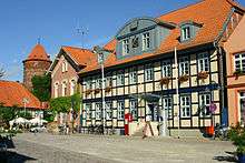
Old city hall of Dannenberg
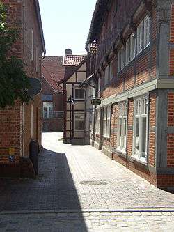
Dannenberg is a town in the district Lüchow-Dannenberg, in Lower Saxony, Germany. It is situated near the river Elbe, approx. 30 km north of Salzwedel, and 50 km south-east of Lüneburg. Dannenberg has a population of 8,147 inhabitants (December 2010).
Dannenberg is located on the German Timber-Frame Road.
It is the seat of the Samtgemeinde ("collective municipality") Elbtalaue.
The actual history of the town began with the construction of the castle (first mentioned in 1153) during the rule of Volrad I, Count of Dannenberg (1153–1169), who had been given the task of settling and securing the territory by Duke Henry the Lion.
The Polabian Names for Dannenberg are Weidars and Woikam.
Twin towns
Dannenberg is twinned with:

People

Theodor Körner by Dora Stock
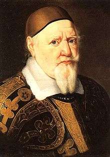
August the Younger in 1666
- Augustus the Younger, Duke of Brunswick-Lüneburg (1579-1666)
- Johannes Schultz (1582-1653), composer
- Augustin Gottfried Ludwig Lentin, (1764-1823), writer and translator of works on chemistry and metallurgy
- Eleonore Prochaska (1785-1813), who died in Dannenberg, female soldier of Napoleonic Wars
- Theodor Körner (1791-1813), wrote in Dannenberg before Battle of the Göhrde the Federal song Before the battle
- Bernhard Riemann (1826-1866), important mathematician
- Harry Bresslau, (1848-1926), Jewish historian and diplomat
- Detlef Weigel (born 1961), development biologist
- Kai Fagaschinski (born 1974), jazz clarinetist and composer
- Nicolas Born (1937-1979), writer
References
External links
| Wikimedia Commons has media related to Dannenberg (Elbe). |
Towns and municipalities in Lüchow-Dannenberg (district) | ||
|---|---|---|
This article is issued from
Wikipedia.
The text is licensed under Creative Commons - Attribution - Sharealike.
Additional terms may apply for the media files.