Dahr Safra
| Dahr Safra ضهر صفرا | |
|---|---|
| Village | |
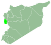
 Dahr Safra Location in Syria | |
| Coordinates: 35°4′45″N 35°55′38″E / 35.07917°N 35.92722°ECoordinates: 35°4′45″N 35°55′38″E / 35.07917°N 35.92722°E | |
| Country |
|
| Governorate | Tartus |
| District | Baniyas District |
| Subdistrict | Rawda |
| Population (2004) | |
| • Total | 1,019 |
| Time zone | UTC+3 (EET) |
| • Summer (DST) | UTC+2 (EEST) |
| City Qrya Pcode | C5379 |
Dahr Safra (Arabic: ضهر صفرا) is a Syrian village in the Baniyas District in Tartous Governorate. According to the Syria Central Bureau of Statistics (CBS), Dahr Safra had a population of 1,019 in the 2004 census.[1]
References
- ↑ "General Census of Population 2004". Retrieved 2017-10-20.
Capital: Tartus | ||||||
|  | |||||
|
| ||||||
| ||||||
| ||||||
This article is issued from
Wikipedia.
The text is licensed under Creative Commons - Attribution - Sharealike.
Additional terms may apply for the media files.