D48 road (Croatia)
| |
|---|---|
| Route information | |
| Length | 19.1 km (11.9 mi) |
| Major junctions | |
| From |
|
|
| |
| To |
|
| Location | |
| Counties | Istria |
| Major cities | Pazin |
| Highway system | |
| State roads in Croatia | |

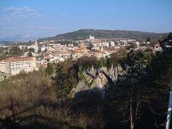
Pazin, at the eastern terminus of D48
D48 is a state road connecting the city of Pazin with D21 and D302 state roads near Baderna, the latter serving as a connecting road to A9/B9 expressway.[1]
The D48 road thus serves as a connection between the two arms of Istrian Y and towns in the centre of Istria peninsula, including Pazin, Baderna and Žminj. The road is 19.1 km (11.9 mi) long.[2]
The road, as well as all other state roads in Croatia, is managed and maintained by Hrvatske ceste, a state-owned company.[3]
Traffic volume
Traffic is regularly counted and reported by Hrvatske ceste, operator of the road.[4] Substantial variations between annual (AADT) and summer (ASDT) traffic volumes are attributed to the fact that the road connects two arms of Istrian Y carrying substantial tourist traffic.
| D48 traffic volume | ||||
| Road | Counting site | AADT | ASDT | Notes |
| 2712 Tinjan | 3,235 | 5,088 | The only published traffic counting site on D48. | |
Road junctions and populated areas
| D48 major junctions/populated areas | |
| Type | Slip roads/Notes |
Ž5190 to Žminj and Svetvinčenat. Eastbound D48 traffic defaults to Ž5190. The eastern terminus of the road. | |
| L50190 to Pazin. | |
| Ž5007 to Karojba and Oprtalj. | |
| Tinjan Ž5075 to Sveti Petar u Šumi. | |
| Jakovići | |
Westbound D48 traffic defaults to D302. The western terminus of the road. | |
Sources
- ↑ "Interchanges of the Y". BINA-Istra. May 15, 2010.
- ↑ "Decision on categorization of public roads as state roads, county roads and local roads". Narodne novine (in Croatian). February 17, 2010.
- ↑ "Public Roads Act". Narodne novine (in Croatian). December 14, 2004.
- ↑ "Traffic counting on the roadways of Croatia in 2009 - digest" (PDF). Hrvatske ceste. May 1, 2010. Archived from the original (PDF) on July 21, 2011.
External links
This article is issued from
Wikipedia.
The text is licensed under Creative Commons - Attribution - Sharealike.
Additional terms may apply for the media files.