Dąbrówka Mała
| Dąbrówka Mała | |
|---|---|
| Katowice District | |
 Church in Dąbrówka Mała | |
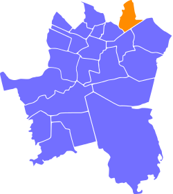 Location of Dąbrówka Mała within Katowice | |
| Coordinates: 50°16′37″N 19°04′51″E / 50.27694°N 19.08083°ECoordinates: 50°16′37″N 19°04′51″E / 50.27694°N 19.08083°E | |
| Country |
|
| Voivodeship | Silesian |
| County/City | Katowice |
| Area | |
| • Total | 3.68 km2 (1.42 sq mi) |
| Population (2007) | |
| • Total | 5,411 |
| • Density | 1,500/km2 (3,800/sq mi) |
| Time zone | UTC+1 (CET) |
| • Summer (DST) | UTC+2 (CEST) |
| Area code(s) | (+48) 032 |
Dąbrówka Mała (German: Kleindombrowka, Eichenau) is a district of Katowice. It has an area of 3.68 km2 and in 2007 had 5,411 inhabitants.[1]
References
- ↑ Urząd Miasta Katowice. "Katowice - Studium uwarunkowań i kierunków zagospodarowania przestrzennego" (PDF) (in Polish). Archived from the original (PDF) on 2011-11-04. Retrieved 2011-06-16.
| Wikimedia Commons has media related to Dąbrówka Mała. |
| I. Central-City |
| |
|---|---|---|
| II. North-City |
| |
| III. West-City | ||
| IV. East-City |
| |
| V. South-City |
| |
This article is issued from
Wikipedia.
The text is licensed under Creative Commons - Attribution - Sharealike.
Additional terms may apply for the media files.