Czerniejów, Gmina Jabłonna
| Czerniejów | |
|---|---|
| Village | |
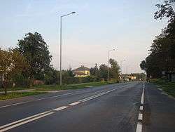 Voivodeship road 835 in Czerniejów | |
 Czerniejów | |
| Coordinates: 51°7′16″N 22°35′59″E / 51.12111°N 22.59972°E | |
| Country |
|
| Voivodeship | Lublin Voivodeship |
| County | Lublin County |
| Gmina | Jabłonna |
Czerniejów [t͡ʂɛrˈɲejuf] is a village in the administrative district of Gmina Jabłonna, within Lublin County, Lublin Voivodeship, in eastern Poland.[1] It lies approximately 4 kilometres (2 mi) north of Jabłonna and 15 km (9 mi) south of the regional capital Lublin.
| Wikimedia Commons has media related to Czerniejów (gmina Jabłonna). |
References
| Seat | ||
|---|---|---|
| Other villages | ||
Coordinates: 51°07′16.5″N 22°35′59.5″E / 51.121250°N 22.599861°E
This article is issued from
Wikipedia.
The text is licensed under Creative Commons - Attribution - Sharealike.
Additional terms may apply for the media files.