Curuá River (Iriri River)
| Curuá River | |
|---|---|
 | |
 Mouth location in Brazil | |
| Native name | Rio Curuá River |
| Country | Brazil |
| Physical characteristics | |
| Main source | Pará |
| River mouth | 5°22′35″S 54°27′09″W / 5.376452°S 54.452500°WCoordinates: 5°22′35″S 54°27′09″W / 5.376452°S 54.452500°W |
| Length | 530[1] |
| Basin features | |
| River system | Iriri River |
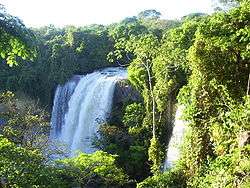
The Curuá River is a tributary of the Iriri River in Pará state in north-central Brazil. It is a tributary of the Iriri River.
The river flows through the Tapajós-Xingu moist forests ecoregion.[2] The river rises in the 342,192 hectares (845,570 acres) Nascentes da Serra do Cachimbo Biological Reserve, a strictly protected conservation unit established in 2005. It is one of the headwaters of the Xingu River.[3]
See also
References
- ↑ Ziesler, R.; Ardizzone, G.D. (1979). "Amazon River System". The Inland waters of Latin America. Food and Agriculture Organization of the United Nations. ISBN 92-5-000780-9. Archived from the original on 8 November 2014.
- ↑ Sears, Robin, Amazon Basin - Brazil (NT0168), WWF: World Wildlife Fund, retrieved 2017-03-20
- ↑ Unidade de Conservação: Reserva Biológica Nascentes Serra do Cachimbo (in Portuguese), MMA: Ministério do Meio Ambiente, retrieved 2016-05-27
This article is issued from
Wikipedia.
The text is licensed under Creative Commons - Attribution - Sharealike.
Additional terms may apply for the media files.