Cumnock, North Carolina
| Cumnock, North Carolina | |
|---|---|
| Unincorporated community | |
 Location of Cumnock in North Carolina  Cumnock, North Carolina (the US) | |
| Coordinates: Coordinates: 35°33′18″N 79°14′16″W / 35.55500°N 79.23778°W | |
| Country | United States |
| State | North Carolina |
| County | Lee |
| Elevation | 272 ft (83 m) |
| Time zone | UTC-5 (Eastern (EST)) |
| • Summer (DST) | UTC-4 (EDT) |
| Area code(s) | 919 |
| GNIS feature ID | 1019884 |
Cumnock is an unincorporated community in northwestern Lee County, North Carolina, United States. It lies on Cumnock Road, about a mile north of U.S. Route 421.
Endor Iron Furnace is located near the community. It was listed on the National Register of Historic Places in 1974.[1] The Deep River Camelback Truss Bridge was listed in 1995.[1]
Geography
Cumnock is located at 35°33′18″N 79°14′16″W / 35.55500°N 79.23778°W (35.5548727, -79.2377981), near the center of North Carolina.
References
- 1 2 National Park Service (2010-07-09). "National Register Information System". National Register of Historic Places. National Park Service.
External links
Municipalities and communities of Lee County, North Carolina, United States | ||
|---|---|---|
| City | 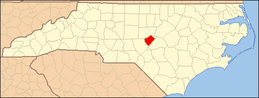 | |
| Town | ||
| Unincorporated communities | ||
| Footnotes | ‡This populated place also has portions in an adjacent county or counties | |
This article is issued from
Wikipedia.
The text is licensed under Creative Commons - Attribution - Sharealike.
Additional terms may apply for the media files.