Cumberland, Virginia
| Cumberland, Virginia | |
|---|---|
| Census-designated place | |
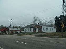 Central Cumberland in 2015 | |
 Cumberland Location in Virginia  Cumberland Cumberland (the US) | |
| Coordinates: 37°29′46″N 78°14′43″W / 37.49611°N 78.24528°WCoordinates: 37°29′46″N 78°14′43″W / 37.49611°N 78.24528°W | |
| Country | United States |
| State | Virginia |
| County | Cumberland |
| Area | |
| • Total | 4.19 sq mi (10.84 km2) |
| • Land | 4.17 sq mi (10.79 km2) |
| • Water | 0.02 sq mi (0.06 km2) |
| Elevation | 455 ft (139 m) |
| Population (2010) | |
| • Total | 393 |
| • Density | 94/sq mi (36.4/km2) |
| Time zone | UTC−5 (Eastern (EST)) |
| • Summer (DST) | UTC−4 (EDT) |
| ZIP code | 23040 |
| FIPS code | 51-20768 |
| GNIS feature ID | 1498472 |
Cumberland is a census-designated place (CDP) in and the county seat of Cumberland County, Virginia, United States.[1] Cumberland lies along U.S. Route 60 and State Route 45. It is 48 miles (77 km) west of Richmond and 51 miles (82 km) east of Amherst. The population as of the 2010 Census was 393.[2]
References
- ↑ "Find a County". National Association of Counties. Archived from the original on 2011-05-31. Retrieved 2011-06-07.
- ↑ "Geographic Identifiers: 2010 Demographic Profile Data (G001): Cumberland CDP, Virginia". U.S. Census Bureau, American Factfinder. Retrieved August 26, 2015.
Municipalities and communities of Cumberland County, Virginia, United States | ||
|---|---|---|
| Town |  | |
| CDP | ||
| Unincorporated communities | ||
| Footnotes | ‡This populated place also has portions in an adjacent county or counties | |
This article is issued from
Wikipedia.
The text is licensed under Creative Commons - Attribution - Sharealike.
Additional terms may apply for the media files.