Cartersville, Cumberland County, Virginia
| Cartersville, Virginia | |
|---|---|
| Unincorporated community | |
 Cartersville  Cartersville | |
| Coordinates: 37°40′03″N 78°05′18″W / 37.66750°N 78.08833°W | |
| Country | United States |
| State | Virginia |
| County | Cumberland |
| Elevation | 259 ft (79 m) |
| Time zone | UTC-5 (Eastern (EST)) |
| • Summer (DST) | UTC-4 (EDT) |
| Area code(s) | Area code |
| GNIS ID | 1492721[1] |
Cartersville is an unincorporated community in Cumberland County, in the U.S. state of Virginia.
Cartersville formed around the James River and Kanawha Canal. An 1855 gazetteer described it as having "1 church, several stores, and about 50 dwellings."[2]
A number of properties on the National Register of Historic Places are located in and around Cartersville; among these are the plantation house Ampthill, the Cartersville Bridge, Hamilton High School, and Morven, as well as the Cartersville Historic District.
Climate
Climate is characterized by relatively high temperatures and evenly distributed precipitation throughout the year. The Köppen Climate Classification subtype for this climate is "Cfa" (Humid Subtropical Climate).[3]
| Climate data for Cartersville, Virginia | |||||||||||||
|---|---|---|---|---|---|---|---|---|---|---|---|---|---|
| Month | Jan | Feb | Mar | Apr | May | Jun | Jul | Aug | Sep | Oct | Nov | Dec | Year |
| Average high °C (°F) | 8 (47) |
9 (49) |
15 (59) |
21 (69) |
26 (78) |
29 (84) |
31 (88) |
30 (86) |
27 (81) |
22 (71) |
16 (60) |
9 (49) |
20 (68) |
| Average low °C (°F) | −4 (25) |
−4 (25) |
1 (33) |
6 (42) |
11 (52) |
16 (61) |
18 (65) |
18 (64) |
14 (57) |
7 (44) |
1 (34) |
−3 (27) |
7 (44) |
| Average precipitation mm (inches) | 79 (3.1) |
69 (2.7) |
89 (3.5) |
86 (3.4) |
89 (3.5) |
89 (3.5) |
109 (4.3) |
109 (4.3) |
86 (3.4) |
84 (3.3) |
71 (2.8) |
80 (3) |
1,034 (40.7) |
| Source: Weatherbase [4] | |||||||||||||
External links
References
- ↑ U.S. Geological Survey Geographic Names Information System: Cartersville, Cumberland County, Virginia
- ↑ Edwards, Richard (1855). Statistical Gazetteer of the State of Virginia. Richmond, Virginia: Richard Edwards. p. 199.
- ↑ Climate Summary for Cartersville, Virginia
- ↑ "Weatherbase.com". Weatherbase. 2013. Retrieved on August 20, 2013.
Municipalities and communities of Cumberland County, Virginia, United States | ||
|---|---|---|
| Town | 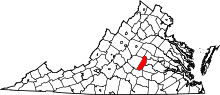 | |
| CDP | ||
| Unincorporated communities | ||
| Footnotes | ‡This populated place also has portions in an adjacent county or counties | |
This article is issued from
Wikipedia.
The text is licensed under Creative Commons - Attribution - Sharealike.
Additional terms may apply for the media files.