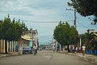
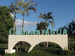
Cumanayagua
| Cumanayagua | |
|---|---|
| Municipality | |
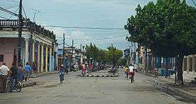 A road in the town centre | |
.png) Cumanayagua municipality (red) within Cienfuegos Province (yellow) and Cuba | |
 Location of Cumanayagua in Cuba | |
| Coordinates: 22°09′8″N 80°12′4″W / 22.15222°N 80.20111°WCoordinates: 22°09′8″N 80°12′4″W / 22.15222°N 80.20111°W | |
| Country |
|
| Province | Cienfuegos |
| Established | 1976 |
| Area[1] | |
| • Total | 1,099 km2 (424 sq mi) |
| Elevation | 60 m (200 ft) |
| Population (2004)[2] | |
| • Total | 51,435 |
| • Density | 46.8/km2 (121/sq mi) |
| Time zone | UTC-5 (EST) |
| Area code(s) | +53-432 |
Cumanayagua (Spanish pronunciation: [kumanaˈʝaɣwa]) is a municipality and town in the Cienfuegos Province of Cuba. It is located in a valley near the Guamuhaya Mountains (usually these mountains are referred as Escambray Mountains, 23 kilometres (14 mi) east of Cienfuegos, the provincial capital.
History
Cumanayagua was inhabited by Cuban Taino indigenous people when the Spanish arrived to the island.[3] Though the meaning of the name is uncertain, is known it comes from Taino Arawak origin. Some scholars believe it means "The place filled with flowers of Royal Palms" other believe it could mean "The place of Cuma and Anayagua", Cuma was the aboriginal chief ruler of the region, and Anayagua his daughter and heir to the chiefdom.[3]
The village was established by Spanish and Cuban creole under Colonial times with a longer name; "San Felipe de Cumanayagua" which it retain until 1878 when it was changed into "Santa Cruz de Cumanayagua", and finally at the turn of the 20th century got its definitive and shorter Taino name it has today.[3]
Geography
Located in the south-eastern corner of the province, by the Caribbean Coast and at the borders with the province of Villa Clara and Sancti Spíritus; the municipal territory includes part of Escambray Mountain Range and the nature reserves of Topes de Collantes and Pico San Juan. The town lies in south of Avilés Reservoir and is crossed by the Hanabanilla River.[4]
The municipality borders with the ones of Cienfuegos, Palmira, Cruces, Manicaragua and Trinidad. It counts several hamlets (villages and localities), as Arimao, Barajagua, Camilo Cienfuegos, Entronque de Minas, Gavillán, Guajimico, Hoyo de Padilla, La Clara, La Sierrita, Las Moscas, Playa El Inglés, Playa Yaguanabo, San Blas, San Francisco and San Juan.[4]
Demographics
In 2004, the municipality of Cumanayagua had a population of 51,435.[2] With a total area of 1,099 km2 (424 sq mi),[1] it has a population density of 46.8/km2 (121/sq mi).
Economy
Citrus fruits and coffee are grown in the municipality of Cumanayagua.
See also
References
- 1 2 Statoids (July 2003). "Municipios of Cuba". Retrieved 2007-10-07.
- 1 2 Atenas.cu (2004). "2004 Population trends, by Province and Municipality" (in Spanish). Archived from the original on 2007-09-27. Retrieved 2007-10-07.
- 1 2 3 (in Spanish) Cumanayagua on EcuRed
- 1 2 482488265 Cumanayagua on OpenStreetMap
External links
![]()