Culloden, Highland
Culloden
| |
|---|---|
 Culloden House, 2004 | |
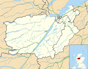 Culloden Culloden shown within the Inverness area | |
| OS grid reference | NH721463 |
| Council area | |
| Country | Scotland |
| Sovereign state | United Kingdom |
| Postcode district | IV2 7 |
| Police | Scottish |
| Fire | Scottish |
| Ambulance | Scottish |
| EU Parliament | Scotland |
Culloden (/kəˈlɒdən/[1] ![]()
History
Culloden village was originally made up of estate houses attached to Culloden House.[3] Historic buildings include Culloden House itself, which is now a hotel, the Culloden stables, now rebuilt as holiday homes, and the historic tithe barn which is now the Barn Church. Additional interesting buildings nearby include the Loch Lann Kennels, the Doocot and the ice house. In the 1960s an area near the historic village was drained for a council housing project, including Culloden Stores, Culloden Academy[4] and Duncan Forbes Primary School, named after the Forbeses of Culloden, who owned Culloden House from 1626 to 1897. More recent private housing developments have since grown up around it. Culloden House is now a luxury country house hotel.
The parish of Culloden includes three other communities: Balloch /bəˈlɒx/, Smithton and Westhill. Like Culloden, Balloch is a village of some antiquity. Smithton and Westhill are post-war housing developments.
Battlefield of Culloden
Today, the battlefield of Culloden is under the care of the National Trust for Scotland, and its visitors' centre is a huge tourist attraction. A visitor centre has recently been built by the National Trust for Scotland and includes an interactive battle experience including an immersion film battle room.[5] The visitor centre was officially opened to the public on 16 April 2008.[6]
Clootie well
Apart from the battlefield, the most notable site in the surrounding area is the "clootie well," in Culloden Woods, where brightly coloured rags are hung as offerings from people wishing to be cured of ailments.This well was traditionally visited on the first Sunday in May. Up until the early Seventies this pilgrimage was well attended with 'buses laid on to cater for the crowds. The practise of visiting on a specific day has declined sharply in recent years. A similar, and better known, well is near Munlochy. This tradition may be based on Celtic ceremonies, involving votive offerings to water spirits. The Cairns of Clava, a group of Bronze Age burial mounds, are located at Balnauran of Clava, about one mile (1.6 km) south-east of the battlefield.
References
- ↑ Collins Dictionary
- ↑
- Computer-generated virtual panoramas Culloden Moor Index
- ↑ Ordnance Survey grid reference for Culloden House: NH721464
- ↑ Culloden Academy website Archived 2006-04-27 at the Wayback Machine.
- ↑ The New Culloden Visitor Centre Archived 2008-10-21 at the Wayback Machine.
- ↑ The Official Opening of the Visitor Centre, stv News 16 April 2008