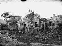
Cuba Street, Wellington

Cuba Street is one of the most prominent streets in Wellington, New Zealand. The section between Dixon Street and Ghuznee Street is a pedestrian mall.
Despite the number of older buildings in the street, there was little building damage from the 2016 Kaikoura earthquake.[1]
Location and origin

Named after an early (1840) settler ship to New Zealand, the Cuba, it is to the south of the CBD, but still in the inner city. Cuba Street was once the route of the Wellington trams. Following the removal of the rails, the middle section of the street was closed to traffic in 1969, and is now a pedestrian mall and is one of the busiest areas of pedestrian activity in Wellington. Since 1995, Cuba Street has been a registered Historic Area under the Historic Places Act 1993, with numerous buildings being of historic significance,[2] the Bank of New Zealand building being one of those.
Literary History
Mary Taylor (1817-1893), lifelong friend and correspondent of author Charlotte Brontë owned and ran a small Cuba Street general store, circa 1840-1860. The shop no longer exists but a heritage storyboard at the intersection of Cuba and Dixon streets commemorates her.[3]
Local people and activities

It is one of the more bohemian areas of Wellington, and is the home to an eclectic collection of cafes, op-shops, boutique, small fashion stores, art galleries, and music shops. It is the centre of one of the four 'quarters' of downtown Wellington, the Cuba Quarter (the others being centred on Lambton Quay, Courtenay Place and Willis Street).
The Bucket Fountain is a prominent sculpture in the pedestrianised "Mall" part of the street. Cuba Street has been popular with many members of Wellington's homeless community, including the Wellington icon Blanket Man. Recently (2018) some retailers have moved into the adjacent Ghuznee Street.[4]
The northern end is more commercial, with an abundance of retail stores, cafes and restaurants. While the southern end (known as the 'top' of Cuba Street, or upper Cuba) is more sparsely occupied but has seen a revival in recent years. In the mid 70s to early 80s, "Mid Cuba" or Vivian Street (which crosses Cuba St) was Wellington's notorious Red light district, where prostitutes would loiter, strip clubs, peep shows and gay bars sat side by side. In recent years, remnants of the red light district are still visible, but sparse.
The street is regarded by most New Zealanders as a nexus of creativity and artistic production, featuring buskers, exhibition spaces, protests, stone carving, and other forms of expression. In 2005, the new Wellington Arts Centre was established in Abel Smith Street, a half block from upper Cuba Street. Within a few blocks are Enjoy Gallery, {Suite} Gallery, Peter McLeavey Gallery, the Moko (Tattoo) Museum, Thistle Hall, Victoria University of Wellington Faculty of Architecture and Design, and Access Radio.
Music and venues
Cuba Dupa is an annual street party celebrating Cuba Street.[5]
Fat Freddy's Drop's first album, Live at the Matterhorn was recorded at the bar. Other venues in the area include Hotel Bristol, San Francisco Bathhouse, Bar Bodega, J.J. Murphy's, Southern Cross, S&M Bar, Midnight Espresso, Olive, K Bar, Hope Brothers, Havana Bar, Good Luck, The Duke, and Logan Brown. The lower end of Cuba Street ends at Wellington Town Hall, Civic Square, Michael Fowler Centre, and Wakefield Street.
References
- ↑ "Miracle on Cuba Street". Stuff (Fairfax Media). 21 November 2016.
- ↑ "Cuba Street Historic Area". Register of Historic Places. Heritage New Zealand. Retrieved 2009-12-01.
- ↑ "Mary Taylor, friend of Charlotte Bronte - The Cuba Street Memories Project". Kete.wcl.govt.nz. Retrieved 2016-02-29.
- ↑ "Business exodus from Cuba Street is Ghuznee's gain as new precinct thrives". Stuff (Fairfax). 2 May 2018.
- ↑ "CubaDupa - 24th and 25th March 2018". www.cubadupa.co.nz. Retrieved 2018-10-10.
External links
| Wikimedia Commons has media related to Cuba Street, Wellington. |
Coordinates: 41°17′30″S 174°46′36″E / 41.291747°S 174.776562°E