Crouch, Idaho
| Crouch, Idaho | |
|---|---|
| City | |
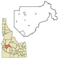 Location of Crouch in Boise County, Idaho. | |
| Coordinates: 44°6′56″N 115°58′21″W / 44.11556°N 115.97250°WCoordinates: 44°6′56″N 115°58′21″W / 44.11556°N 115.97250°W | |
| Country | United States |
| State | Idaho |
| County | Boise |
| Area[1] | |
| • Total | 0.38 sq mi (0.98 km2) |
| • Land | 0.36 sq mi (0.93 km2) |
| • Water | 0.02 sq mi (0.05 km2) |
| Elevation | 3,048 ft (929 m) |
| Population (2010)[2] | |
| • Total | 162 |
| • Estimate (2016)[3] | 163 |
| • Density | 452.78/sq mi (174.71/km2) |
| Time zone | UTC-7 (Mountain (MST)) |
| • Summer (DST) | UTC-6 (MDT) |
| ZIP code | 83622 |
| Area code(s) | 208 |
| FIPS code | 16-19720 |
| GNIS feature ID | 0396348 |
Crouch is a city in Boise County, Idaho, United States. The population was 162 at the 2010 census. It is part of the Boise City–Nampa, Idaho Metropolitan Statistical Area. In 1990, it had only three commercial businesses for tourists and residents: a small grocery mart, a diner, and a bar. At that time, the construction of the Banks/Lowman highway began, which transformed a small unpaved road unto a paved modern road between Crouch and Lowman. During construction, the road was closed periodically. Now it is a fully modern paved roadway that serves to transport tourists, rafters, commuters, and other traffic across the middle Idaho region.
The city was founded in 1934, and named for resident William Crouch.[4]
Geography
Crouch is located at 44°6′56″N 115°58′21″W / 44.11556°N 115.97250°W (44.115496, -115.972536).[5]
According to the United States Census Bureau, the city has a total area of 0.44 square miles (1.14 km2), of which, 0.42 square miles (1.09 km2) is land and 0.02 square miles (0.05 km2) is water.[6]
Demographics
| Historical population | |||
|---|---|---|---|
| Census | Pop. | %± | |
| 1960 | 89 | — | |
| 1970 | 71 | −20.2% | |
| 1980 | 69 | −2.8% | |
| 1990 | 75 | 8.7% | |
| 2000 | 154 | 105.3% | |
| 2010 | 162 | 5.2% | |
| Est. 2016 | 163 | [3] | 0.6% |
| U.S. Decennial Census[7] | |||
2010 census
As of the census[2] of 2010, there were 162 people, 74 households, and 43 families residing in the city. The population density was 385.7 inhabitants per square mile (148.9/km2). There were 90 housing units at an average density of 214.3 per square mile (82.7/km2). The racial makeup of the city was 96.9% White, 1.2% Native American, 0.6% Asian, and 1.2% from two or more races. Hispanic or Latino of any race were 1.9% of the population.
There were 74 households of which 24.3% had children under the age of 18 living with them, 48.6% were married couples living together, 6.8% had a female householder with no husband present, 2.7% had a male householder with no wife present, and 41.9% were non-families. 32.4% of all households were made up of individuals and 8.1% had someone living alone who was 65 years of age or older. The average household size was 2.19 and the average family size was 2.81.
The median age in the city was 48.8 years. 21.6% of residents were under the age of 18; 7.4% were between the ages of 18 and 24; 16.7% were from 25 to 44; 37% were from 45 to 64; and 17.3% were 65 years of age or older. The gender makeup of the city was 53.7% male and 46.3% female.
2000 census
As of the census[8] of 2000, there were 154 people, 64 households, and 38 families residing in the city. The population density was 366.8 people per square mile (141.6/km²). There were 83 housing units at an average density of 197.7 per square mile (76.3/km²). The racial makeup of the city was 97.40% White, 0.65% Native American, 0.65% Pacific Islander, 1.30% from other races. Hispanic or Latino of any race were 1.95% of the population.
There were 64 households out of which 32.8% had children under the age of 18 living with them, 42.2% were married couples living together, 10.9% had a female householder with no husband present, and 39.1% were non-families. 28.1% of all households were made up of individuals and 9.4% had someone living alone who was 65 years of age or older. The average household size was 2.41 and the average family size was 3.03.
In the city, the population was spread out with 30.5% under the age of 18, 5.8% from 18 to 24, 23.4% from 25 to 44, 23.4% from 45 to 64, and 16.9% who were 65 years of age or older. The median age was 40 years. For every 100 females, there were 113.9 males. For every 100 females age 18 and over, there were 109.8 males.
The median income for a household in the city was $29,375, and the median income for a family was $32,500. Males had a median income of $26,667 versus $21,875 for females. The per capita income for the city was $17,343. About 18.4% of families and 18.8% of the population were below the poverty line, including 34.5% of those under the age of eighteen and none of those sixty five or over.
Climate
This climatic region has large seasonal temperature differences, with warm to hot (and often humid) summers and cold (sometimes severely cold) winters. According to the Köppen Climate Classification system, Crouch has a humid continental climate, abbreviated "Dfb" on climate maps.[9]
References
- ↑ "2016 U.S. Gazetteer Files". United States Census Bureau. Retrieved Jul 26, 2017.
- 1 2 "American FactFinder". United States Census Bureau. Retrieved 2012-12-18.
- 1 2 "Population and Housing Unit Estimates". Retrieved June 9, 2017.
- ↑ Boone, Lalia. Idaho Place Names. 1988.
- ↑ "US Gazetteer files: 2010, 2000, and 1990". United States Census Bureau. 2011-02-12. Retrieved 2011-04-23.
- ↑ "US Gazetteer files 2010". United States Census Bureau. Archived from the original on January 24, 2012. Retrieved 2012-12-18.
- ↑ "Census of Population and Housing". Census.gov. Archived from the original on May 12, 2015. Retrieved June 4, 2015.
- ↑ "American FactFinder". United States Census Bureau. Archived from the original on September 11, 2013. Retrieved 2008-01-31.
- ↑ Climate Summary for Crouch, Idaho
Municipalities and communities of Boise County, Idaho, United States | ||
|---|---|---|
| Cities | ||
| CDPs | ||
| Unincorporated communities | ||