Crançot
| Crançot | |
|---|---|
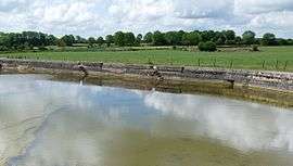 The Sauget | |
 Crançot Location within Bourgogne-Franche-Comté region  Crançot | |
| Coordinates: 46°41′13″N 5°39′38″E / 46.6869°N 5.6606°ECoordinates: 46°41′13″N 5°39′38″E / 46.6869°N 5.6606°E | |
| Country | France |
| Region | Bourgogne-Franche-Comté |
| Department | Jura |
| Arrondissement | Lons-le-Saunier |
| Canton | Poligny |
| Government | |
| • Mayor (2014–2020) | Daniel Ségut |
| Area1 | 14.37 km2 (5.55 sq mi) |
| Population (2012)2 | 595 |
| • Density | 41/km2 (110/sq mi) |
| Time zone | UTC+1 (CET) |
| • Summer (DST) | UTC+2 (CEST) |
| INSEE/Postal code | 39177 /39570 |
| Elevation | 450–561 m (1,476–1,841 ft) |
|
1 French Land Register data, which excludes lakes, ponds, glaciers > 1 km2 (0.386 sq mi or 247 acres) and river estuaries. 2 Population without double counting: residents of multiple communes (e.g., students and military personnel) only counted once. | |
Crançot is a former commune in the Jura department in Bourgogne-Franche-Comté in eastern France. On 1 January 2016, it was merged into the new commune of Hauteroche.[1]
Population
| Historical population | ||
|---|---|---|
| Year | Pop. | ±% |
| 1793 | 580 | — |
| 1806 | 604 | +4.1% |
| 1821 | 635 | +5.1% |
| 1831 | 642 | +1.1% |
| 1841 | 638 | −0.6% |
| 1851 | 631 | −1.1% |
| 1861 | 608 | −3.6% |
| 1872 | 572 | −5.9% |
| 1881 | 508 | −11.2% |
| 1891 | 473 | −6.9% |
| 1901 | 422 | −10.8% |
| 1911 | 404 | −4.3% |
| 1921 | 385 | −4.7% |
| 1931 | 364 | −5.5% |
| 1946 | 366 | +0.5% |
| 1954 | 348 | −4.9% |
| 1962 | 362 | +4.0% |
| 1968 | 376 | +3.9% |
| 1975 | 355 | −5.6% |
| 1982 | 454 | +27.9% |
| 1990 | 485 | +6.8% |
| 1999 | 489 | +0.8% |
| 2006 | 484 | −1.0% |
| 2012 | 595 | +22.9% |
See also
References
- ↑ Arrêté préfectoral 4 December 2015
| Wikimedia Commons has media related to Crançot. |
This article is issued from
Wikipedia.
The text is licensed under Creative Commons - Attribution - Sharealike.
Additional terms may apply for the media files.